Tenerife Mountain

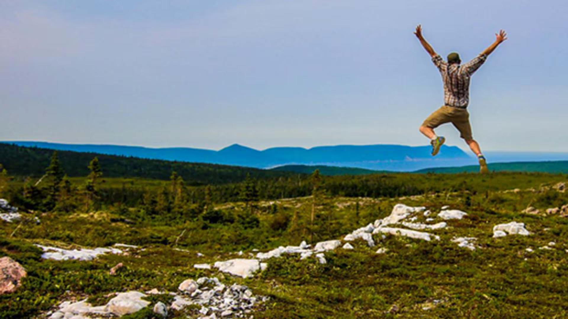
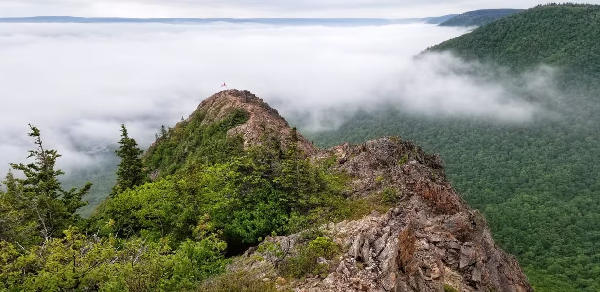
Tenerife Peak, also known as Theodore Fricker Mountain, is a hidden gem on Cape Breton Island, the trailhead is located between the villages of Cape North and Dingwall. Blink and you’ll miss the start of the trail which takes you up through a beautiful forest. 

The trail starts off gentle then takes you up a very steep slope for the remainder of the time, watch for loose rock as you near the top. As you near the summit, you’ll be above the trees and the reward is stunning 360-degree views of the surrounding landscape. After you’ve caught your breath hike the short ridge-line for even more beautiful views.

Waterfall

North River Falls Provincial Park

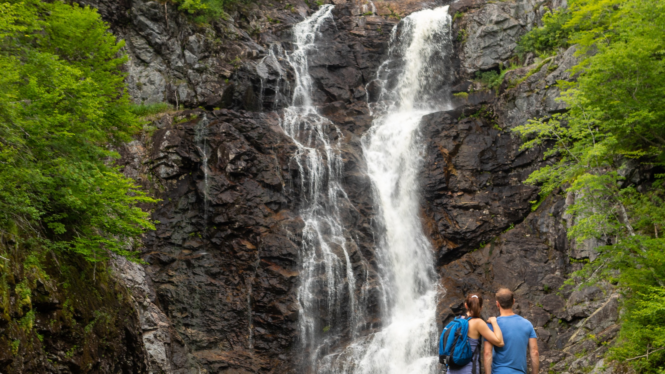
North River Falls

Height: 30 m

Distance (one way): 9 km

Difficulty: Moderate (distance)

Elevation: 680 m

Hiking Time: 6-8 hours

Cellphone Coverage: No

***Please note that this trail has experienced serious degradation and should only be traversed by experienced hikers***

Finding the Trailhead: On the Cabot Trail northeast of Baddeck, drive to North River Bridge. On the east side of the bridge across the North River, turn onto Oregon Road and drive to the end where you will see the entrance to the North River Falls Provincial Park and the trailhead. Park here.

Trailhead:  46°19’05.7"N 60°39’44.6"W Waterfall: 46°22’13.6"N 60°41’58.5"W

The Hike: The trailhead is marked with a sign where you parked. The trail at first is quite broad and well used. A little distance past the midpoint of the hike, the trail becomes a little more challenging. The valley narrows quite a lot, and the trail has been constructed in such a way that you need to need to cross several tributaries to the East Branch of the North River. Unfortunately, bridges on this section may be out of commission due to heavy ice flows in the spring. After a challenging hike, you are rewarded with a huge waterfall.

North River Wilderness Area straddles the North River valley, west of St. Anns Harbour, Victoria County. Expanded in 2015, this wilderness area protects more than 5,000 hectares of highland plateau, uplands and rugged river valley.

This area features outstanding examples of geological, fluvial and ecological processes. Mature-old deciduous forest ecosystems are found along the lower valley slopes, together with some hemlock. Pure hemlock stands also occur, such as the “Oregon site” (recognized by the International Biological Program), where tree ages range from regenerating seedlings to mature trees of over 190 years, with individuals reaching ages of over 250 year near the river. The higher elevation elevation areas support a more boreal forest of balsam fir and spruce, as well as wetlands and ponds.

Salmon in the North River are one of the few healthy and self-sustaining early-run sea winter stocks remaining in Nova Scotia. The river contains gravel spawning beds, deep holding pools, and the cold water conditions required by salmon.

The North River is well known as a regional recreation destination, especially for anglers and hikers.

Foot paths along North River have been used by generations of anglers travelling up and down the river to popular salmon pools. These trails meander beside the river for several kilometres, passing through fascinating river-side habitats and forests. They also provide scenic views of waterfalls, pools, and the steep slopes of the canyon ecosystem.

The well-known North River Falls Trail (9 km each way) follows the river valley to the base of North River Falls. At over 32 metres, this is reputed to be the highest falls in the province. Other hiking opportunities on unmanaged trail are found in the south west of the area, where a day hike to the top of Bald Mountain is rewarded with a stunning view of the surrounding wilderness area and countryside.

Guests at Ski Tuonela, near Goose Cove, can enjoy backcountry skiing within North River Wilderness Area, to the look-off at Bald Mountain.

The expanded wilderness area includes the small, former North River Provincial Park, including the trail head of the North River Falls hiking trail. This trail head is a major access point for angling and hiking and will continue to be maintained for public access and enjoyment.

The wilderness area extends to the western side of the forest access road from Oregon to the highlands (off-highway vehicle trail #814). This road can be used to access the wilderness area. Road conditions may be poor.

About 600 m of electrical transmission line passes through the southeastern part of the wilderness area. Nova Scotia Power (NSPI) retains the authority to operate and maintain this transmission line.
Mica Hill Trail

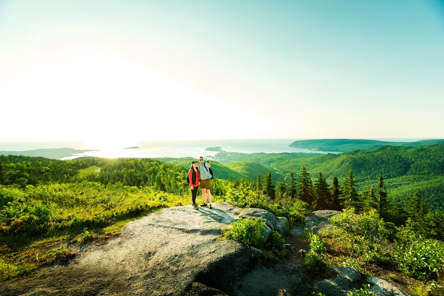
This breathtaking trail winds through Acadian mixed forest and stunted taiga as it climbs to the windswept plateau. It offers 360° views spanning the barrens, the dramatic Aspy fault, coastal villages far below and mountains reaching the most northern tip of Cape Breton. Continue along a narrower footpath to Mica Hill’s remarkable displays of mica glittering amongst the quartz boulders. Explore a small side loop past Paquette Lake on your return.

Trailhead: Take the Paquette Lake road and park at the lake 

Significant Feature: Highlands taiga, mica-quartz pegmatite
Length: 7.9 km (4.9 mi) return; 8.4 km (5.2 mi) with loop

Hiking Time: 3–4 hours

Elevation: 260–400 m (850–1345 ft.) Gradual climb.
Trail Rating: Moderate

GPS Co-ordinates for Trailhead (in decimal degrees): Lat: 46.834629 Long: -60.434124

Open from mid-May to mid-October. A park pass is required for hiking or use of other services in the park; park entry fee applies. Check in at the Parks Canada visitor centres in Chéticamp (16 Visitor Centre Rd., situated on the west side of the park) or in Ingonish (37637 Cabot Trail, on the east side of the park) to obtain passes, information on visitor safety and any other information you may need, including a trail location map.

For your comfort and safety:

  • Do not approach, disturb or feed wild animals.
  • Take along appropriate clothing – rapid weather changes often occur on the plateau or along the coast.
  • Carry water with you, especially for longer trails, climbs or open barrens.
  • Bring insect repellent as black flies and mosquitoes are common all summer.
  • Mountain bikes are permitted only where indicated, for public safety and protection of the environment.
  • Stay on designated trails and boardwalks to protect fragile vegetation.
  • Do not throw food or scraps along the trails or roads.
  • Read "Keep it Wild, Keep it Safe" brochure, available at park visitor centres and on the Parks Canada website.
  • Recreational drone use is prohibited within the national park for the safety of wildlife and other visitors.

Franey Trail

 Climb through a lush forest to one of the park’s most breathtaking summits. At the top, expansive 360° views reveal the Clyburn Brook canyon, the Atlantic coastline from Cape Smokey to Ingonish, and the dramatic rocky face of Franey Mountain. Moose are often spotted along the way, adding to the wilderness experience.

The trail has been recently realigned to offer two scenic loops, both leading to unforgettable vistas. Access the trailhead at the end of Franey Road.


Length:

4.5 km / 2.7 mi (lower loop)

13 km / 8 mi (full loop)


Rating: Difficult — Longer trails with steep sections suitable for prepared visitors with trail experience.

Elevation:

17 – 170 m (55 – 557 ft) (lower loop)

17 – 423 m (55 – 1,387 ft) (full loop)


Time:

1.5 – 2 hours (lower loop)

5 – 6 hours (full loop)

GPS Co-ordinates for Trailhead (in decimal degrees): Lat: 46.660766, Long: -60.422683

Open from mid-May to mid-October. A park pass is required for hiking or use of other services in the park; park entry fee applies. Check in at the Parks Canada visitor centres in Chéticamp (16 Visitor Centre Rd., situated on the west side of the park) or in Ingonish (37637 Cabot Trail, on the east side of the park) to obtain passes, information on visitor safety and any other information you may need, including a trail location map.

For your comfort and safety:

  • Do not approach, disturb or feed wild animals.
  • Take along appropriate clothing – rapid weather changes often occur on the plateau or along the coast.
  • Carry water with you, especially for longer trails, climbs or open barrens.
  • Bring insect repellent as black flies and mosquitoes are common all summer.
  • Mountain bikes are permitted only where indicated, for public safety and protection of the environment.
  • Stay on designated trails and boardwalks to protect fragile vegetation.
  • Do not throw food or scraps along the trails or roads.
  • Read "Keep it Wild, Keep it Safe" brochure, available at park visitor centres and on the Parks Canada website.
  • Recreational drone use is prohibited within the national park for the safety of wildlife and other visitors.

Fishing Cove Trail

You are 355 metres (1165 feet) above sea level! 

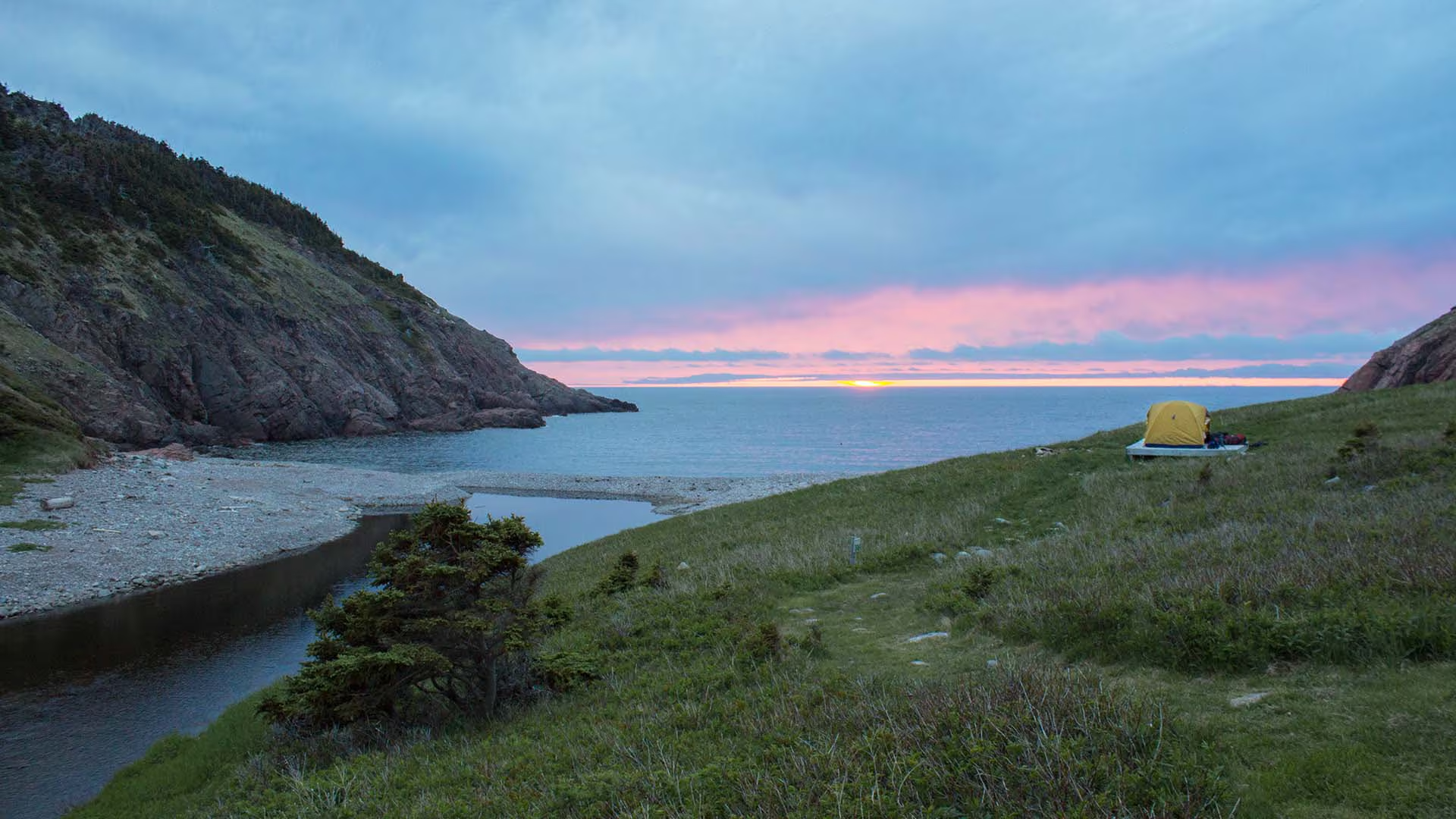
Hike from the top of the mountain about 6 kilometres down to a small ocean cove and grassy clearing – the only designated wilderness camp site in the park. This was once the site of a Scottish fishing community and these settlers traded with the French for supplies. Explore the beach, roam the hills or swim in fresh or salt water. You must register at a Parks Canada visitor centre prior to camping.

Trailhead: On the Cabot Trail at the top of MacKenzie Mountain. 

Significant Feature: Acadian forest, ocean cove and headlands 
Length: 12 km (7.5 mi) return

Hiking Time: 5–6 hours

Elevation: 0–355 m (0–1165 ft.) Steep descent. Some muddy sections. No potable water on site. If camping, bring your own toilet paper.
Trail Rating: Difficult


GPS Co-ordinates for Trailhead (in decimal degrees): Lat: 46.761030 Long: -60.834544

Park is open year-round but full visitor services are only available from mid-May until mid-October.

A park pass is required all year for hiking or use of other services in the park; park entry fee applies. Check in at the Parks Canada visitor centres in Chéticamp (16 Visitor Centre Rd., situated on the west side of the park) or in Ingonish (37637 Cabot Trail, on the east side of the park) to obtain passes, information on visitor safety and any other information you may need, including a trail location map.

For your comfort and safety:

  • Do not approach, disturb or feed wild animals.
  • Take along appropriate clothing – rapid weather changes often occur on the plateau or along the coast.
  • Carry water with you, especially for longer trails, climbs or open barrens.
  • Bring insect repellent as black flies and mosquitoes are common all summer.
  • Mountain bikes are permitted only where indicated, for public safety and protection of the environment.
  • Stay on designated trails and boardwalks to protect fragile vegetation.
  • Do not throw food or scraps along the trails or roads.
  • Read "Keep it Wild, Keep it Safe" brochure, available at park visitor centres and on the Parks Canada website.- Recreational drone use is prohibited within the national park for the safety of wildlife and other visitors. 

Aspy Trail

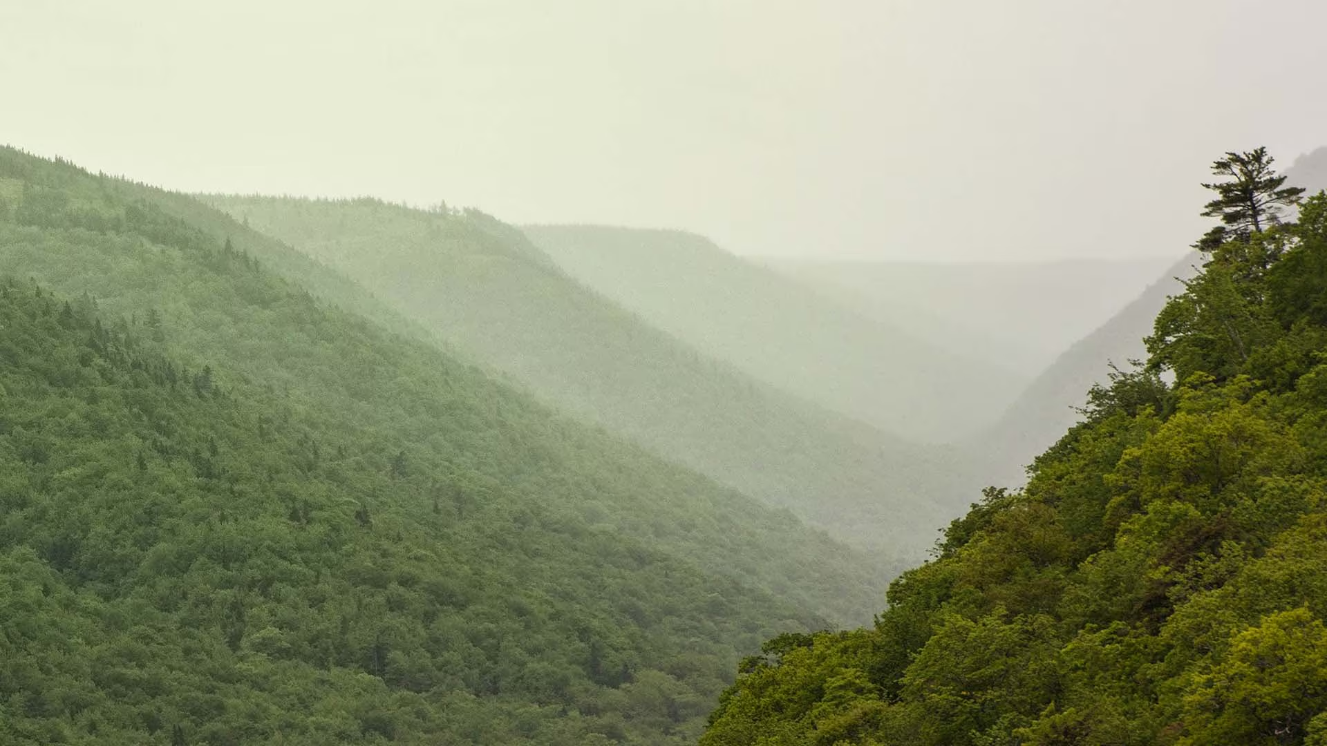
This trail meanders along the Aspy fault, through an Acadian and mixed forest. As nature reclaims land once used for farming and logging, a regenerated forest begins to blend in with the old growth. The magnificent red oak and the hoots of the barred owl or great horned owl will appeal to the true nature enthusiast. Waterproof hiking boots are recommended.

Trailhead: At the parking lot for Beulach Ban Falls
Significant Features: Acadian and mixed forest
Length: 9.6 km (6 mi) return
Hiking time: 3–4 hours
Elevation: 60–450 m (200–1,500 ft)
Short climbs. Rugged sections.
Trail Rating: Moderate/Difficult

GPS Co-ordinates for Trailhead (in decimal degrees):
Lat: 46.814041 Long: -60.626273

Park is open year-round but full visitor services are only
available from mid-May until mid-October. A park pass is required for hiking or use of other services in the park; park entry fee applies. Check in at the Parks Canada visitor centres in Chéticamp (16 Visitor Centre Rd., situated on the west side of the park) or in Ingonish (37637 Cabot Trail, on the east side of the park) to obtain passes, information on visitor safety and any other information you may need, including a trail location map.

For your comfort and safety:
– Do not approach, disturb or feed wild animals.
– Take along appropriate clothing – rapid weather changes often occur on the plateau or along the coast.
– Carry water with you, especially for longer trails, climbs or open barrens.
– Bring insect repellent as black flies and mosquitoes are common all summer.
– Mountain bikes are permitted only where indicated, for public safety and protection of the environment.
– Stay on designated trails and boardwalks to protect fragile vegetation.
– Do not throw food or scraps along the trails or roads.
– Read “Keep it Wild, Keep it Safe” brochure, available at park visitor centres and on the Parks Canada website.- Recreational drone use is prohibited within the national park for the safety of wildlife and other visitors