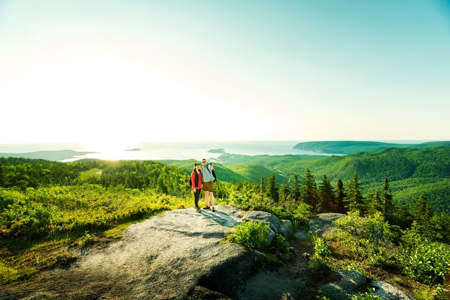
Franey Trail

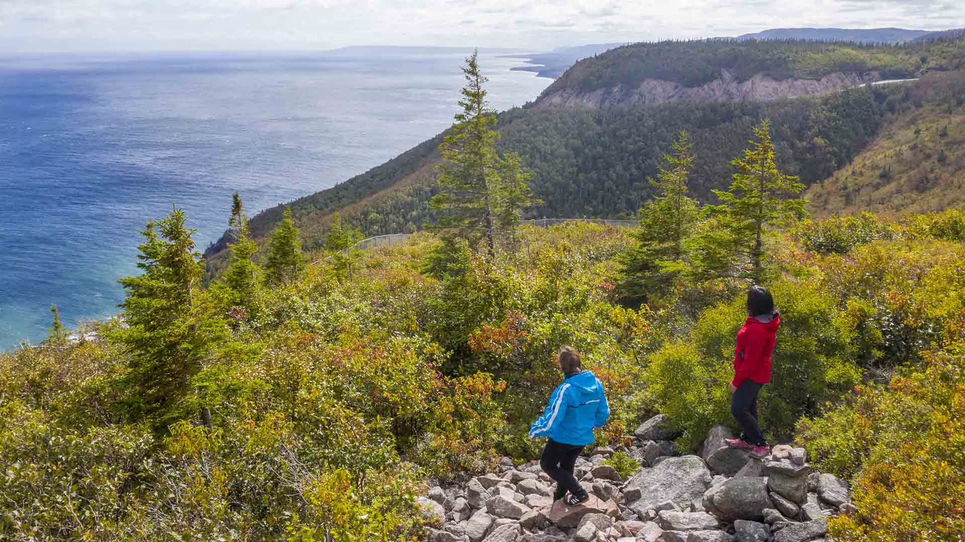
 Climb through a lush forest to one of the park’s most breathtaking summits. At the top, expansive 360° views reveal the Clyburn Brook canyon, the Atlantic coastline from Cape Smokey to Ingonish, and the dramatic rocky face of Franey Mountain. Moose are often spotted along the way, adding to the wilderness experience.

The trail has been recently realigned to offer two scenic loops, both leading to unforgettable vistas. Access the trailhead at the end of Franey Road.


Length:

4.5 km / 2.7 mi (lower loop)

13 km / 8 mi (full loop)


Rating: Difficult — Longer trails with steep sections suitable for prepared visitors with trail experience.

Elevation:

17 – 170 m (55 – 557 ft) (lower loop)

17 – 423 m (55 – 1,387 ft) (full loop)


Time:

1.5 – 2 hours (lower loop)

5 – 6 hours (full loop)

GPS Co-ordinates for Trailhead (in decimal degrees): Lat: 46.660766, Long: -60.422683

Open from mid-May to mid-October. A park pass is required for hiking or use of other services in the park; park entry fee applies. Check in at the Parks Canada visitor centres in Chéticamp (16 Visitor Centre Rd., situated on the west side of the park) or in Ingonish (37637 Cabot Trail, on the east side of the park) to obtain passes, information on visitor safety and any other information you may need, including a trail location map.

For your comfort and safety:

  • Do not approach, disturb or feed wild animals.
  • Take along appropriate clothing – rapid weather changes often occur on the plateau or along the coast.
  • Carry water with you, especially for longer trails, climbs or open barrens.
  • Bring insect repellent as black flies and mosquitoes are common all summer.
  • Mountain bikes are permitted only where indicated, for public safety and protection of the environment.
  • Stay on designated trails and boardwalks to protect fragile vegetation.
  • Do not throw food or scraps along the trails or roads.
  • Read "Keep it Wild, Keep it Safe" brochure, available at park visitor centres and on the Parks Canada website.
  • Recreational drone use is prohibited within the national park for the safety of wildlife and other visitors.
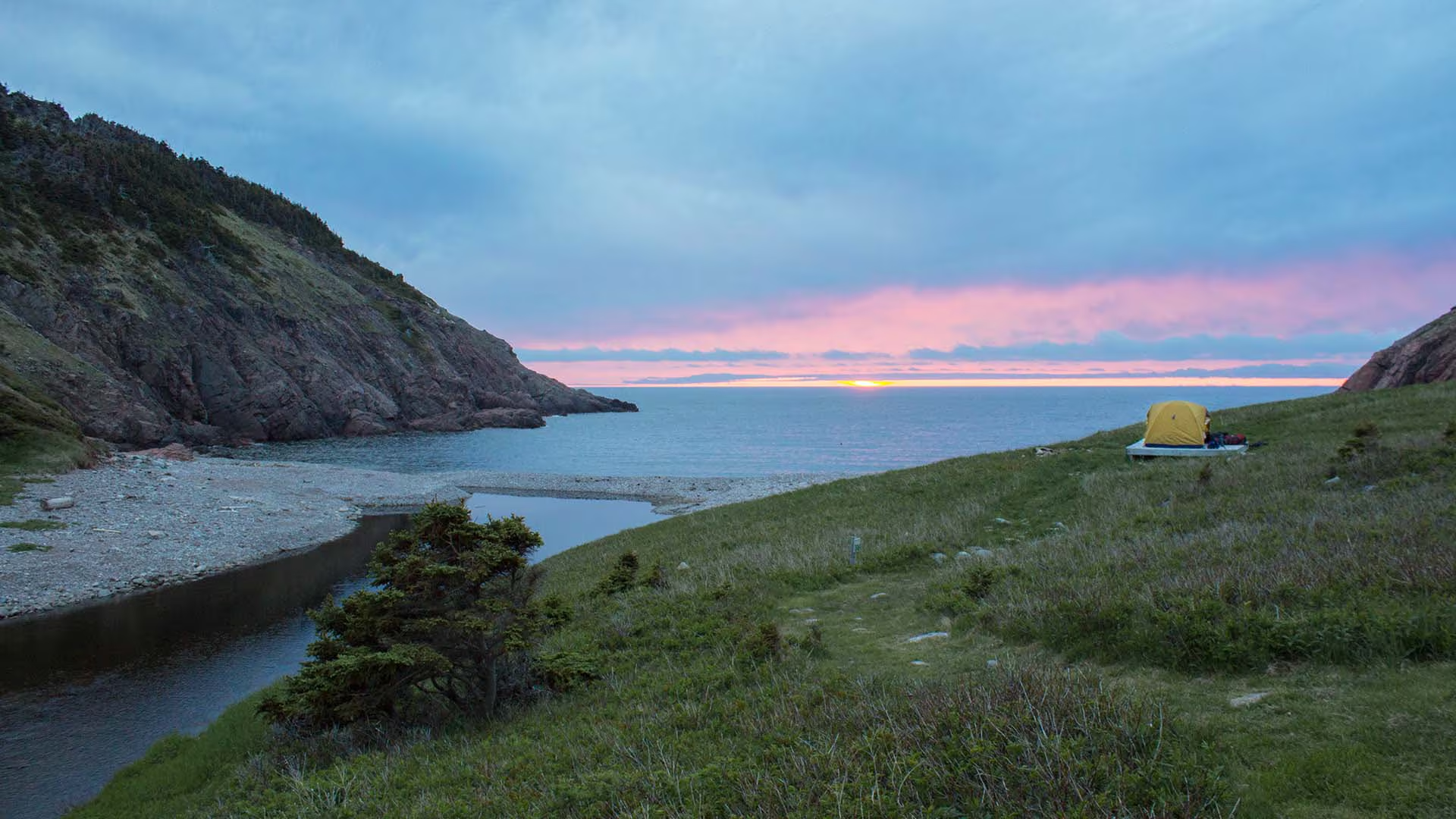
Fishing Cove Trail

You are 355 metres (1165 feet) above sea level! 

Hike from the top of the mountain about 6 kilometres down to a small ocean cove and grassy clearing – the only designated wilderness camp site in the park. This was once the site of a Scottish fishing community and these settlers traded with the French for supplies. Explore the beach, roam the hills or swim in fresh or salt water. You must register at a Parks Canada visitor centre prior to camping.

Trailhead: On the Cabot Trail at the top of MacKenzie Mountain. 

Significant Feature: Acadian forest, ocean cove and headlands 
Length: 12 km (7.5 mi) return

Hiking Time: 5–6 hours

Elevation: 0–355 m (0–1165 ft.) Steep descent. Some muddy sections. No potable water on site. If camping, bring your own toilet paper.
Trail Rating: Difficult


GPS Co-ordinates for Trailhead (in decimal degrees): Lat: 46.761030 Long: -60.834544

Park is open year-round but full visitor services are only available from mid-May until mid-October.

A park pass is required all year for hiking or use of other services in the park; park entry fee applies. Check in at the Parks Canada visitor centres in Chéticamp (16 Visitor Centre Rd., situated on the west side of the park) or in Ingonish (37637 Cabot Trail, on the east side of the park) to obtain passes, information on visitor safety and any other information you may need, including a trail location map.

For your comfort and safety:

  • Do not approach, disturb or feed wild animals.
  • Take along appropriate clothing – rapid weather changes often occur on the plateau or along the coast.
  • Carry water with you, especially for longer trails, climbs or open barrens.
  • Bring insect repellent as black flies and mosquitoes are common all summer.
  • Mountain bikes are permitted only where indicated, for public safety and protection of the environment.
  • Stay on designated trails and boardwalks to protect fragile vegetation.
  • Do not throw food or scraps along the trails or roads.
  • Read "Keep it Wild, Keep it Safe" brochure, available at park visitor centres and on the Parks Canada website.- Recreational drone use is prohibited within the national park for the safety of wildlife and other visitors. 
Eco-Capers

Explore the geology at Presqu’ile’s rocky beach, discover the flora and fauna of trails in the Acadian and boreal forests, investigate the fascinating life in a bog, and dip your toe in the rich marine environment. Every weekday brings a new, hands-on adventure. Ask for details on locations and register at the visitor centres or campground kiosks.

Monday – Friday

July and August – 3 pm

cape smokey winter

Cape Smokey

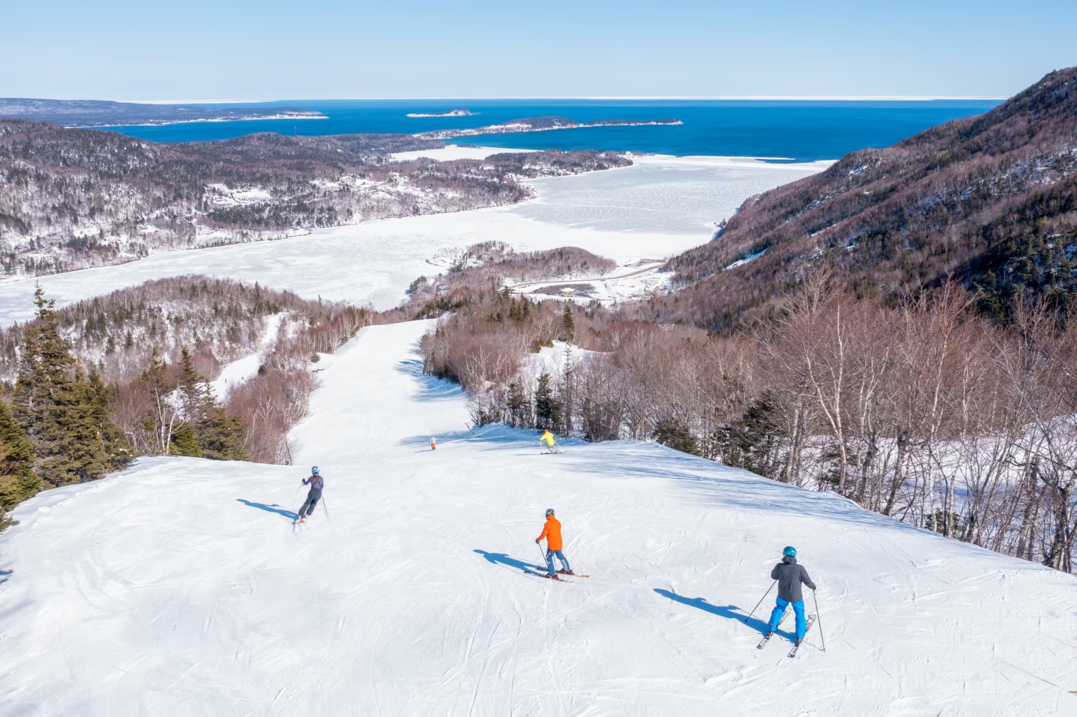
Cape Smokey sits high above the Atlantic along the world famous Cabot Trail in Ingonish, Cape Breton Island. It is Atlantic Canada’s only ski to ocean destination, a place where mountain adventure meets the rugged beauty of the coastline and where every season offers something different to experience.

In winter, Cape Smokey becomes one of the most unique ski destinations in Canada. Skiers and snowboarders carve runs with sweeping views of the Atlantic Ocean, creating a true ski to ocean experience found nowhere else in the country. The mountain offers downhill skiing and snowboarding terrain, rentals, ski school, and snowshoeing, along with classic après ski experiences that make the hill welcoming for visitors of all experience levels.

At the heart of the mountain is Atlantic Canada’s only year round gondola. The ride carries visitors from the base of the mountain to breathtaking summit views overlooking the Atlantic Ocean and Cape Breton Highlands National Park. In winter the gondola provides easy access to the slopes, while also offering a scenic experience for visitors who simply want to take in the dramatic coastal views.

During the warmer months, the gondola becomes the starting point for a range of mountaintop adventures. From the summit, visitors can explore hiking trails that wind through the forest to Hawley’s Lake, a peaceful mountaintop lake where guests can take out kayaks and enjoy the calm water surrounded by nature. The mountain also offers scenic trails for mountain biking, along with relaxed activities such as disc golf and mini golf, all set against panoramic views of the Atlantic coastline.

Cape Smokey is also a gateway to exploring the Cabot Trail and northern Cape Breton. Nearby experiences include kayaking and paddleboarding at the Ingonish Marina, beaches, world class golf, and direct access to Cape Breton Highlands National Park.

In autumn, the surrounding landscape becomes one of the most spectacular places to experience fall colours along the Cabot Trail. Visitors ride the gondola for sweeping views of the changing foliage and enjoy seasonal events and cultural celebrations including the Celtic Colours International Festival.

At the base of the mountain, The Cape restaurant offers fresh local flavours and a relaxed year round patio where visitors can gather after a day outdoors, enjoy live music, or simply take in the atmosphere of the mountain.

Cape Smokey is also part of the growing Destination Cape Smokey resort vision. New accommodations such as the oceanfront chalets at Cormorant Rock are already welcoming guests, with additional accommodations, services, and experiences continuing to be developed. With each season the destination continues to grow, offering more ways for visitors to stay longer, explore deeper, and experience everything this remarkable part of Cape Breton has to offer.

Whether skiing above the ocean in winter, hiking and kayaking on the mountain in summer, or taking in the colours of autumn along the Cabot Trail, Cape Smokey offers a place where visitors can build an entire Cape Breton adventure around the mountain and the sea.

For updates, events, and visitor information, visit capesmokey.ca or follow Cape Smokey on social media.

Dalem Lake Provincial Park

Dalem Lake Provincial Park is on Cape Breton Island (3 km / 2 mi east of Boularderie East, 4 km/2.5 mi north off Highway 105 at St James Road).  Dalem Lake is a popular park on a small lake with hardwood-shaded tables and a white sand beach.  

There is a boat launch for non-motorized boats and a hiking trail 2.2 km (1.4 mi). 

Park activities include sports fishing, kayaking, canoeing, hiking, bird watching and exploring the area’s wildlife.

Clyburn Trail

Note: Infrastructure improvements in the park may cause delays or reduce services while we complete this important work. We appreciate your understanding at this time.

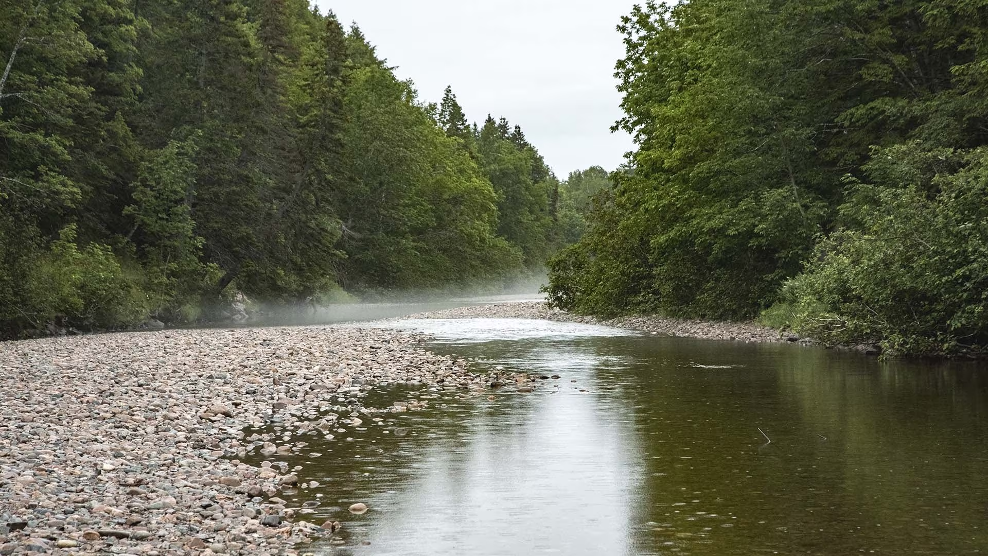
Hikers will marvel at the spectacular stands of hardwood trees, boulders bigger than cars, old abandoned beaver ponds, meadows, apple trees and even the remains of an old gold mine on the Clyburn Valley Trail. This trail follows the river for most of the way, but you can catch a glimpse of the Cape Breton Highlands Links, as it weaves its way up the valley. Feel humbled by the sheer rock face of Franey Mountain 425 m (1400 ft.) above. This level, easy trail is great for a fitness walk or relaxing stroll. Caution: Mountain bikes are permitted but there are rough sections starting about 2 km in. Not recommended for road bikes.

Trailhead: Just north of the Clyburn River bridge 

Significant Feature: Hardwood valley, river, remains of old gold mine

Length: 8.10 km (5 mi) return

Hiking Time: 2–3 hours

Elevation: 5–50 m (15–165 ft.)Relatively level trail. Rough sections where trail floods. Not maintained beyond the gold mine.
Trail Rating: Moderate

GPS Co-ordinates for Trailhead (in decimal degrees): Lat: 46.660688 Long: -60.410384

Park is open year-round but full visitor services are only available from mid-May until mid-October. A park pass is required for hiking or use of other services in the park; park entry fee applies. Check in at the Parks Canada visitor centres in Chéticamp (16 Visitor Centre Rd., situated on the west side of the park) or in Ingonish (37637 Cabot Trail, on the east side of the park) to obtain passes, information on visitor safety and any other information you may need, including a trail location map.

For your comfort and safety:

  • Do not approach, disturb or feed wild animals.
  • Take along appropriate clothing – rapid weather changes often occur on the plateau or along the coast.
  • Carry water with you, especially for longer trails, climbs or open barrens.
  • Bring insect repellent as black flies and mosquitoes are common all summer.
  • Mountain bikes are permitted only where indicated, for public safety and protection of the environment.
  • Stay on designated trails and boardwalks to protect fragile vegetation.
  • Do not throw food or scraps along the trails or roads.
  • Read "Keep it Wild, Keep it Safe" brochure, available at park visitor centres and on the Parks Canada website.- Recreational drone use is prohibited within the national park for the safety of wildlife and other visitors.

Cape Smokey Provincial Park

Cape Smokey Provincial Park is on top of Smokey Mountain along the Cabot Trail on Cape Breton Island. 

With picnic tables and incredible look-off views, Cape Smokey is a popular rest stop for visitors to the Cabot Trail and the Cape Breton Highlands National Park area. The park has great bird watching and photography opportunities. 
A trail, 5 km (3.1 mi) each way, offers even more spectacular views. Rest stops are provided along the way.  Allow 4 hours for this hiking trail.

Cape Breton’s Winter wonderland – TNT’s Snowmobiling Tour in the Cape Breton Highlands

Escape to a Winter Wonderland in Cape Breton!

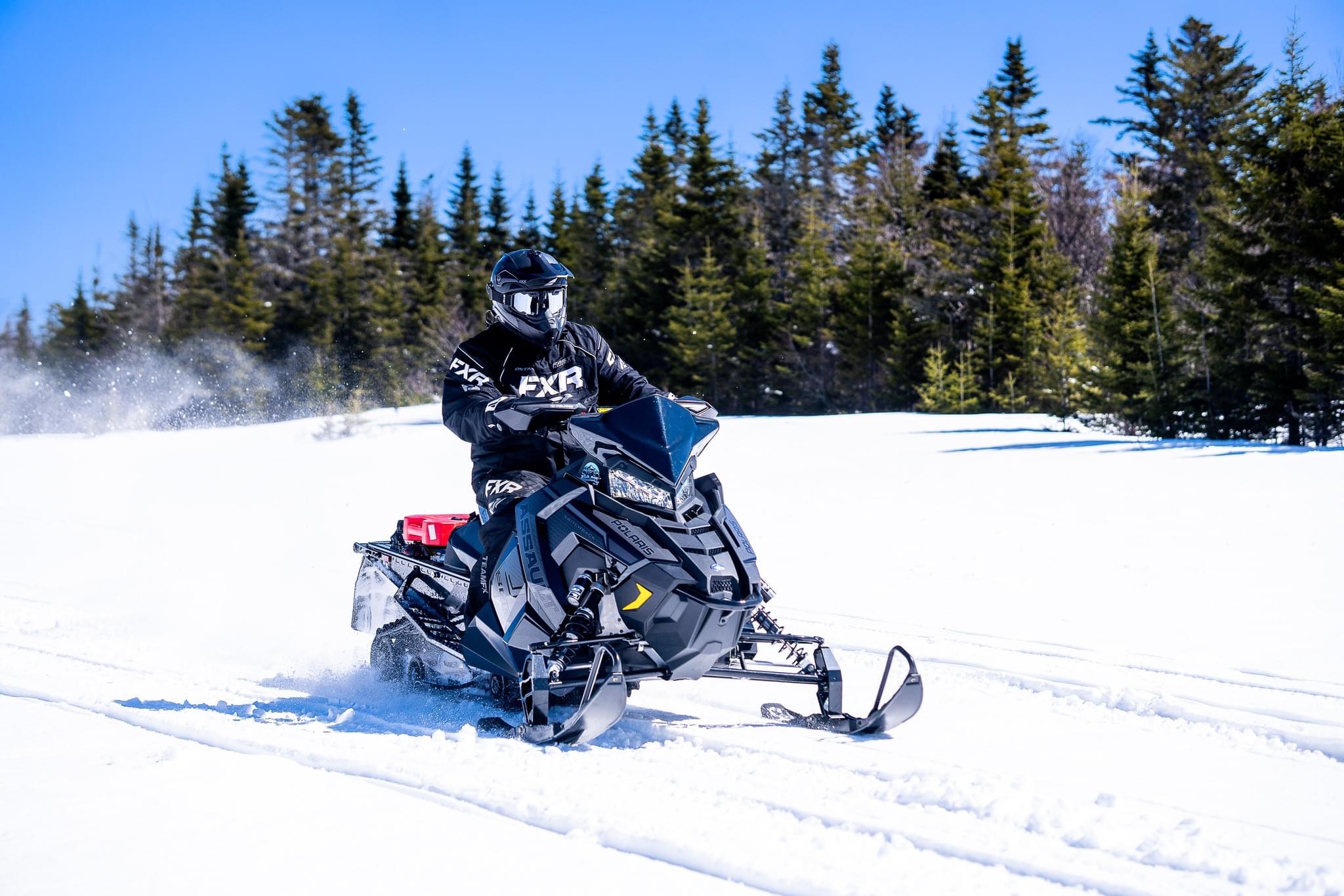
Your adventure begins at TNT’s base camp – 1072 Cabot Trail Road on Hunter’s Mountain, where you will ride through the stunning landscapes of the Cape Breton Highlands toward the breathtaking lookout at Cape Clear. This unforgettable journey showcases some of the island’s most spectacular winter scenery and is truly a must-see experience.

Ride in comfort with our premium CKX snowmobile gear, available in sizes XS–3XL, helping keep you warm and comfortable throughout your adventure. Your tour also includes a hot beverage and light snacks to enjoy along the way.

There may be an opportunity to stop at the iconic Pig ’n Whistle, a perfect place to warm up and experience a local Cape Breton favorite.

Leave the stress of everyday life behind as you explore snow-covered trails, pristine forests, and panoramic vistas accessible only during the winter season. Snowmobiling offers a unique way to discover Cape Breton’s hidden beauty while reconnecting with the excitement and freedom of outdoor adventure.

Experience the thrill of fresh powder, crisp mountain air, and breathtaking views that few get to see. Whether you’re an experienced rider or trying snowmobiling for the first time, this winter adventure will remind you why the season is so magical—bringing back the excitement, wonder, and fun of being a kid again.

Spectacular views. Fresh mountain air. Unforgettable memories. Experience winter with TNT in Cape Breton like never before.

Cabots Landing Provincial Park

Cabots Landing Provincial Park is a picnic and beach park (North Harbour Beach) on the shore of Aspy Bay, 10 km (6 mi) north of the Cabot Trail on Cape Breton Island. Picnic tables are situated in the park’s open fields. Enjoy hiking and beach combing along the sandy beach.  

The Park also features a National Historic Site cairn commemorating the landfall of John Cabot. Cabots Landing was formerly a launching site for Mi’kmaq to paddle to Newfoundland. The park features scenic vistas of the steep face of the Pollets Cove-Aspy Fault Wilderness Area and is a popular rest stop for kayakers, hikers and bicyclists travelling the northern coast of Cape Breton.

Broad Cove Mountain Trail

Note: Infrastructure improvements in the park may cause delays or reduce services while we complete this important work. We appreciate your understanding at this time.

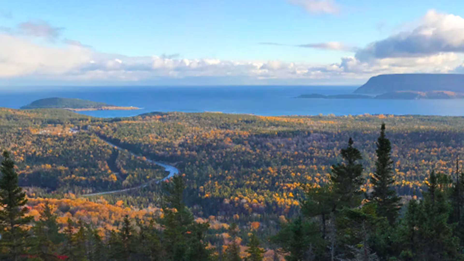
This switchback trail leads through a dense forest of softwood to the top of Broad Cove Mountain for exceptional views of the rocky Atlantic coast, with Middle Head and Cape Smokey in the distance. You climb 168 m over a distance of 1.6 km. Watch for moose along the way and eagles as they soar overhead. Relax at the top and enjoy the vistas below. 

Trailhead: A small parking lot about 1/3 of the way in on Warren Lake Road 

Significant Feature: Ocean, mountain scenery, fall colours 

Length: 2.3 km (1.4 mi) return

Hiking Time: 1 hour

Elevation: 35–180 m (115–590 ft.)Short, steep climb. Rugged sections.
Trail Rating: Moderate

GPS Co-ordinates for Trailhead (in decimal degrees): Lat: 46.7155114 Long: -60.370568

Park is open year-round but full visitor services are only available from mid-May until mid-October. A park pass is required for hiking or use of other services in the park; park entry fee applies. Check in at the Parks Canada visitor centres in Chéticamp (16 Visitor Centre Rd., situated on the west side of the park) or in Ingonish (37637 Cabot Trail, on the east side of the park) to obtain passes, information on visitor safety and any other information you may need, including a trail location map.

For your comfort and safety:

  • Do not approach, disturb or feed wild animals.
  • Take along appropriate clothing – rapid weather changes often occur on the plateau or along the coast.
  • Carry water with you, especially for longer trails, climbs or open barrens.
  • Bring insect repellent as black flies and mosquitoes are common all summer.
  • Mountain bikes are permitted only where indicated, for public safety and protection of the environment.
  • Stay on designated trails and boardwalks to protect fragile vegetation.
  • Do not throw food or scraps along the trails or roads.
  • Read "Keep it Wild, Keep it Safe" brochure, available at park visitor centres and on the Parks Canada website.- Recreational drone use is prohibited within the national park for the safety of wildlife and other visitors.