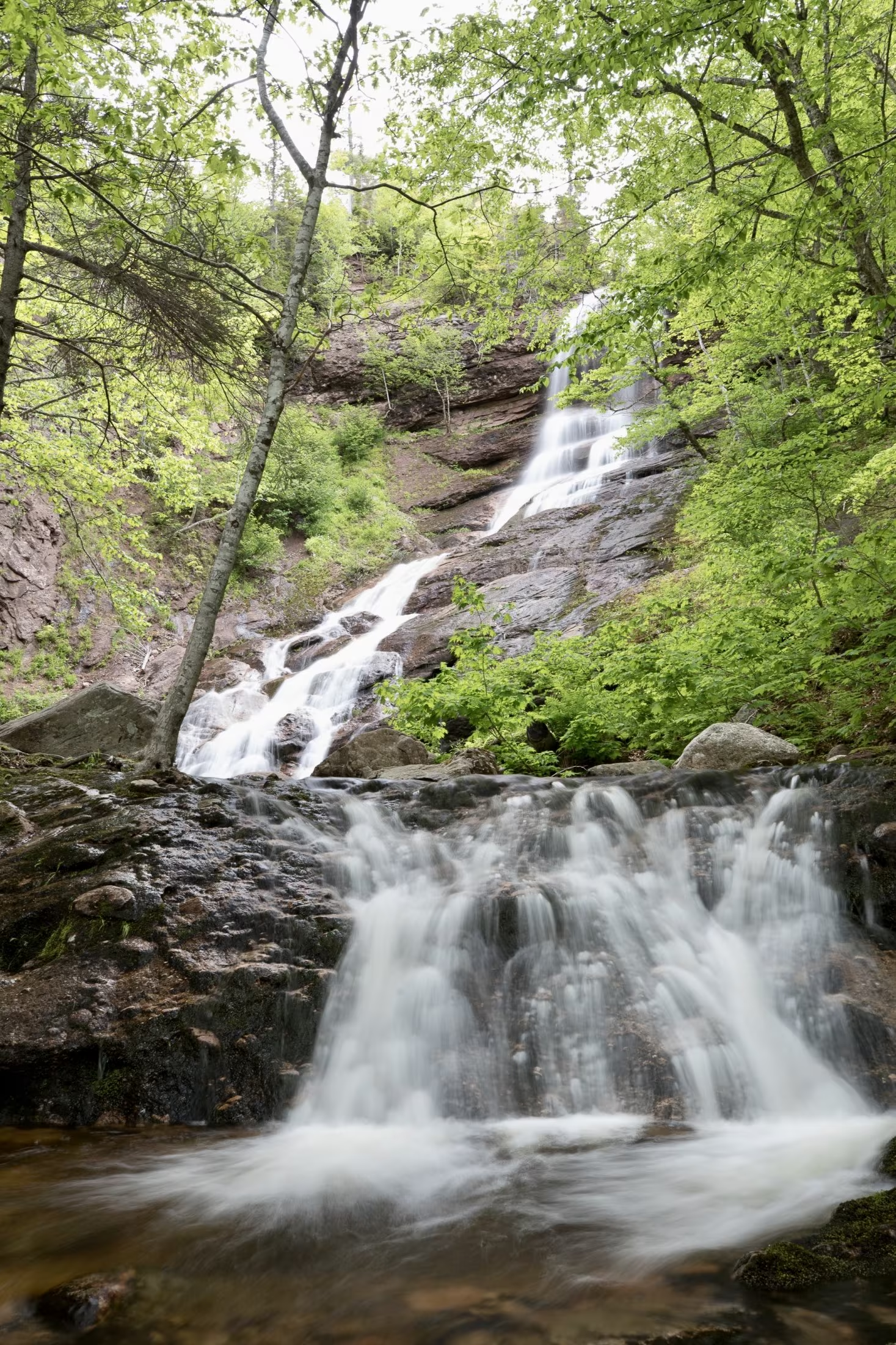
In keeping with Parks Canada’s mandate to protect the natural environment, a boardwalk keeps your feet dry as you walk while preventing you from trampling the fragile life in this highland plateau bog. A self-guiding trail, signs explain life here – pitcher plants, delicate orchids, colourful dragonflies, green frogs and gigantic moose. The trail, as well as the privy at the trailhead, is wheelchair accessible. Ideal for baby strollers.
Trailhead: On the Cabot Trail at the top of French Mountain
Significant Feature: Boreal -Taiga, highland bog
Length: 0.5 km (0.3 mile) loop.
Hiking Time: 15 minutes.
Elevation: 410 m (1345 ft.)
GPS Co-ordinates for Trailhead (in decimal degrees):
Lat: 46.742037 Long: -60.827493
Park is open year-round but full visitor services are only available from mid-May until mid-October. A park pass is required all year for hiking or use of other services in the park. Check in at the Parks Canada Visitor Centres in Chéticamp (16 Visitor Centre Road, just off the Cabot Trail on the west side of the park) or in Ingonish (37637 Cabot Trail, on the east side of the park) to obtain passes, information on visitor safety and any other information you may need, including a trail location map.
For your comfort and safety:
- Do not approach, disturb or feed wild animals.
- Take along appropriate clothing – rapid weather changes often occur on the plateau or along the coast.
- Carry water with you, especially for longer trails, climbs or open barrens.
- Bring insect repellent as black flies and mosquitoes are common all summer.
- Mountain bikes are permitted only where indicated, for public safety and protection of the environment.
- Stay on boardwalks to protect fragile vegetation.
- Do not throw food or scraps along the trails or roads.
- Read "Keep it Wild, Keep it Safe" brochure, available at park visitor centres.
We offer a truly authentic and exceptionally peaceful experience that will have you wanting to come back again.
Located in the heart of Cape Breton, only minutes away from the world renowned Cabot Trail, the links golf courses, and the majestic Margaree and Mabou valleys, our working farm is a retreat for both birds and people alike, boasting over 200 acres of beautiful Acadian forests, wetlands, and pasture.
We have a large fruit orchard, sugar bush, and garden where we produce our own apple cider, maple syrup, vegetables, and more. Wellness and health are at the forefront of Blackbird with in-house registered massage therapy, yoga classes on demand, and forest therapy.
If you are looking for a guided tour, we also offer the opportunity to visit the Island by bicycle, do the best hikes or design the perfect holiday with us. As artists and nature-loving pioneers ,we would love to share our little piece of heaven with you.
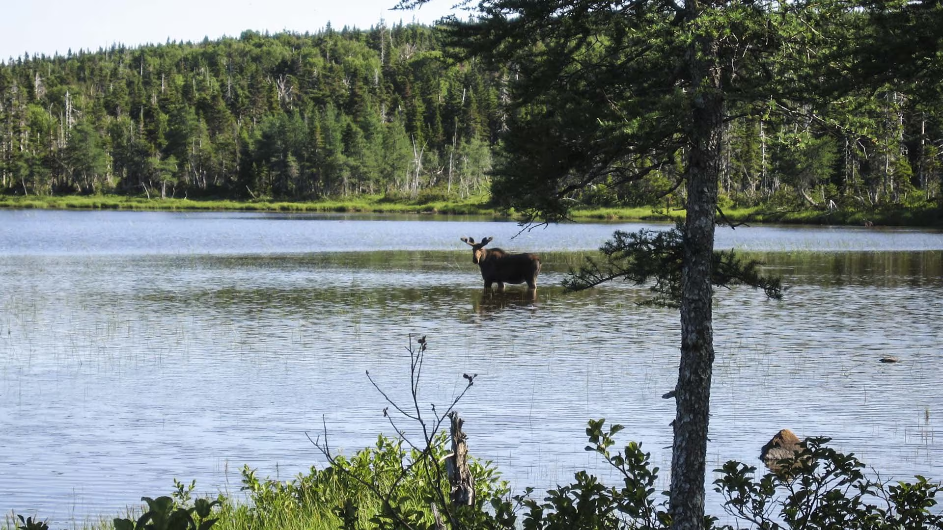
On the plateau at the top of French Mountain, this trail crosses wet barrens and evergreen forests typical of the highlands, ending at a small lake. Boardwalks in some sections keep you dry and protect the habitat from trampling. Moose are frequently seen as well as a variety of northern birds.
Trailhead: On the Cabot Trail at the top of French Mountain
Significant Feature: Boreal highland forestLength: 3 km (1.9 mi) return.
Hiking Time: 1–1.5 hours
Elevation: 400 m (1315 ft.)Level trail, suitable for most skill levels. Some muddy sections.
Trail Rating: Easy
GPS Co-ordinates for Trailhead (in decimal degrees): Lat: 46.747348 Long: -60.821458
Open from mid-May to mid-October. A park pass is required for hiking or use of other services in the park; park entry fee applies. Check in at the Parks Canada visitor centres in Chéticamp (16 Visitor Centre Rd., situated on the west side of the park) or in Ingonish (37637 Cabot Trail, on the east side of the park) to obtain passes, information on visitor safety and any other information you may need, including a trail location map.
For your comfort and safety:
- Do not approach, disturb or feed wild animals.
- Take along appropriate clothing – rapid weather changes often occur on the plateau or along the coast.
- Carry water with you, especially for longer trails, climbs or open barrens.
- Bring insect repellent as black flies and mosquitoes are common all summer.
- Mountain bikes are permitted only where indicated, for public safety and protection of the environment.
- Stay on designated trails and boardwalks to protect fragile vegetation.
- Do not throw food or scraps along the trails or roads.
- Read "Keep it Wild, Keep it Safe" brochure, available at park visitor centres and on the Parks Canada website.- Recreational drone use is prohibited within the national park for the safety of wildlife and other visitors
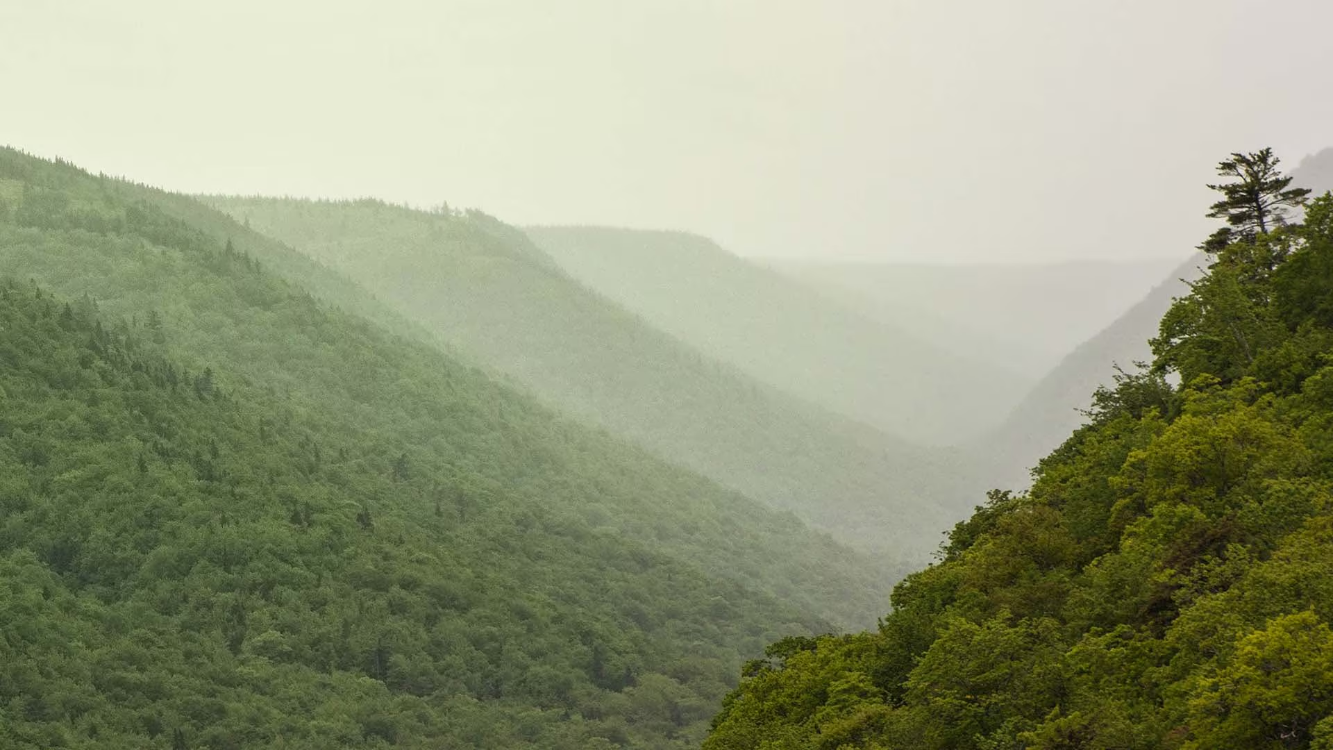
This trail meanders along the Aspy fault, through an Acadian and mixed forest. As nature reclaims land once used for farming and logging, a regenerated forest begins to blend in with the old growth. The magnificent red oak and the hoots of the barred owl or great horned owl will appeal to the true nature enthusiast. Waterproof hiking boots are recommended.
Trailhead: At the parking lot for Beulach Ban Falls
Significant Features: Acadian and mixed forest
Length: 9.6 km (6 mi) return
Hiking time: 3–4 hours
Elevation: 60–450 m (200–1,500 ft)
Short climbs. Rugged sections.
Trail Rating: Moderate/Difficult
GPS Co-ordinates for Trailhead (in decimal degrees):
Lat: 46.814041 Long: -60.626273
Park is open year-round but full visitor services are only
available from mid-May until mid-October. A park pass is required for hiking or use of other services in the park; park entry fee applies. Check in at the Parks Canada visitor centres in Chéticamp (16 Visitor Centre Rd., situated on the west side of the park) or in Ingonish (37637 Cabot Trail, on the east side of the park) to obtain passes, information on visitor safety and any other information you may need, including a trail location map.
For your comfort and safety:
– Do not approach, disturb or feed wild animals.
– Take along appropriate clothing – rapid weather changes often occur on the plateau or along the coast.
– Carry water with you, especially for longer trails, climbs or open barrens.
– Bring insect repellent as black flies and mosquitoes are common all summer.
– Mountain bikes are permitted only where indicated, for public safety and protection of the environment.
– Stay on designated trails and boardwalks to protect fragile vegetation.
– Do not throw food or scraps along the trails or roads.
– Read “Keep it Wild, Keep it Safe” brochure, available at park visitor centres and on the Parks Canada website.- Recreational drone use is prohibited within the national park for the safety of wildlife and other visitors