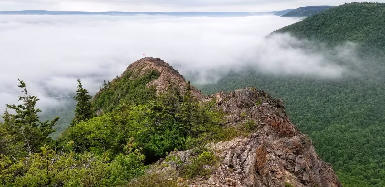
Tenerife Peak, also known as Theodore Fricker Mountain, is a hidden gem on Cape Breton Island, the trailhead is located between the villages of Cape North and Dingwall. Blink and you’ll miss the start of the trail which takes you up through a beautiful forest.
The trail starts off gentle then takes you up a very steep slope for the remainder of the time, watch for loose rock as you near the top. As you near the summit, you’ll be above the trees and the reward is stunning 360-degree views of the surrounding landscape. After you’ve caught your breath hike the short ridge-line for even more beautiful views.
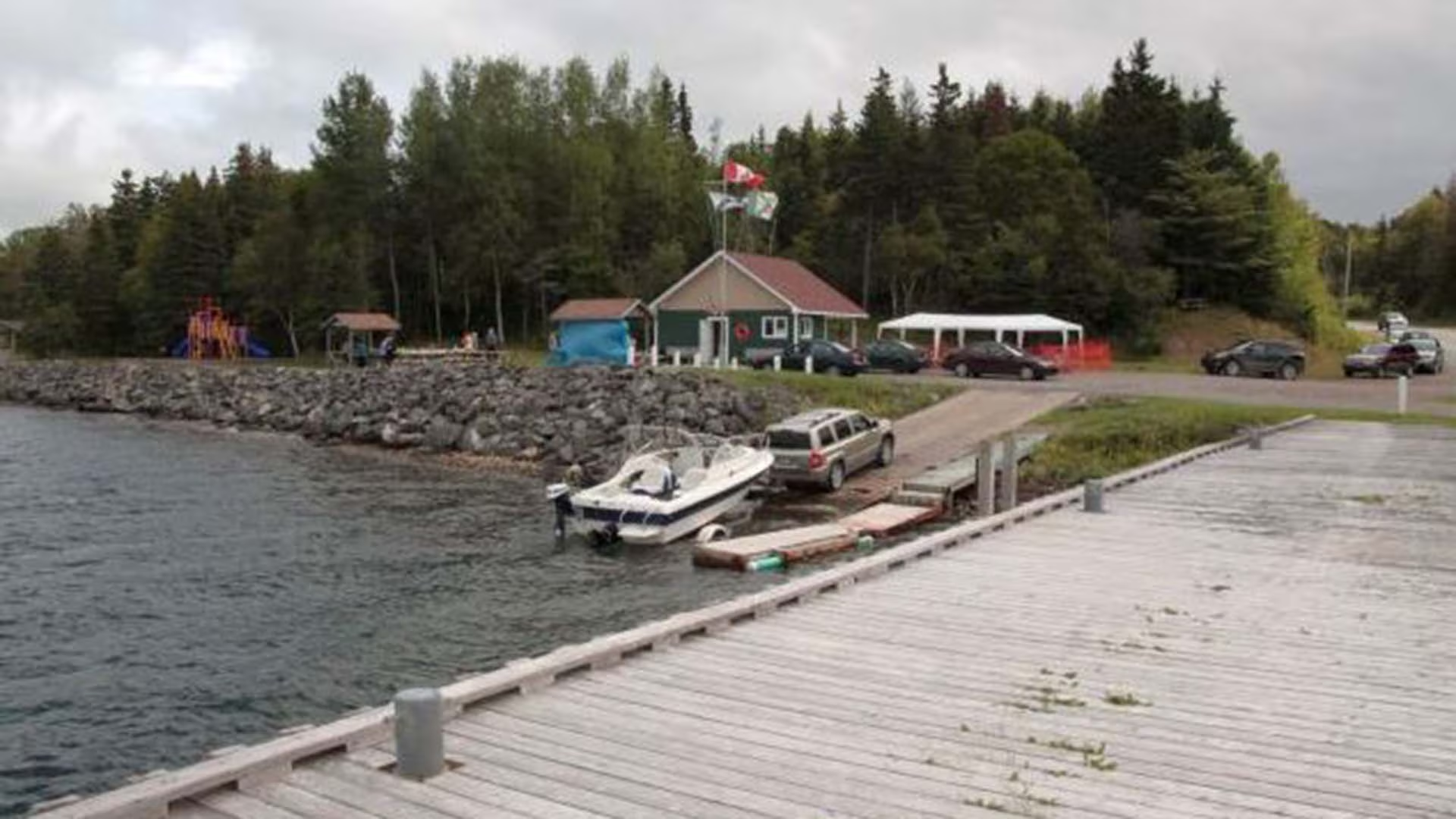
The Ross Ferry Marine Park is located on the scenic Bras d’Or Lake in Cape Breton, Nova Scotia. The Park is on the site of the ferry which operated for many years between Ross Ferry and Big Harbour, across the Great Bras d’Or Channel.
After the Seal Island Bridge opened in 1961 the ferry was closed and the site remained fallow for many years. In the early 2000’s, after decades of deterioration and neglect, local people decided it was time to take matters into their own hands. The Ross Ferry Stewardship Society, a volunteer based community organization, was formed with the intention of improving the site and to providing continued access to the Bras d’Or. The Society negotiated an agreement with the Province of Nova Scotia to manage the site and work began to create the Marine Park.
Significant contributions and assistance were received from the Government of Canada, the Province of Nova Scotia, Victoria County and other public and private sources. With funding in place, a development plan was created and the work of transforming the site began.
Today we have a vibrant community park which includes picnic areas, walking trails, refurbished wharf facilities, a boat launch, and a children’s playground, all in an idyllic setting on the shores of the Bras d’Or.
The park has continued to receive funding from the federal government and municipal governments for summer students but apart from these contributions the operation and maintenance of the park is dependent on local fundraising and donations.
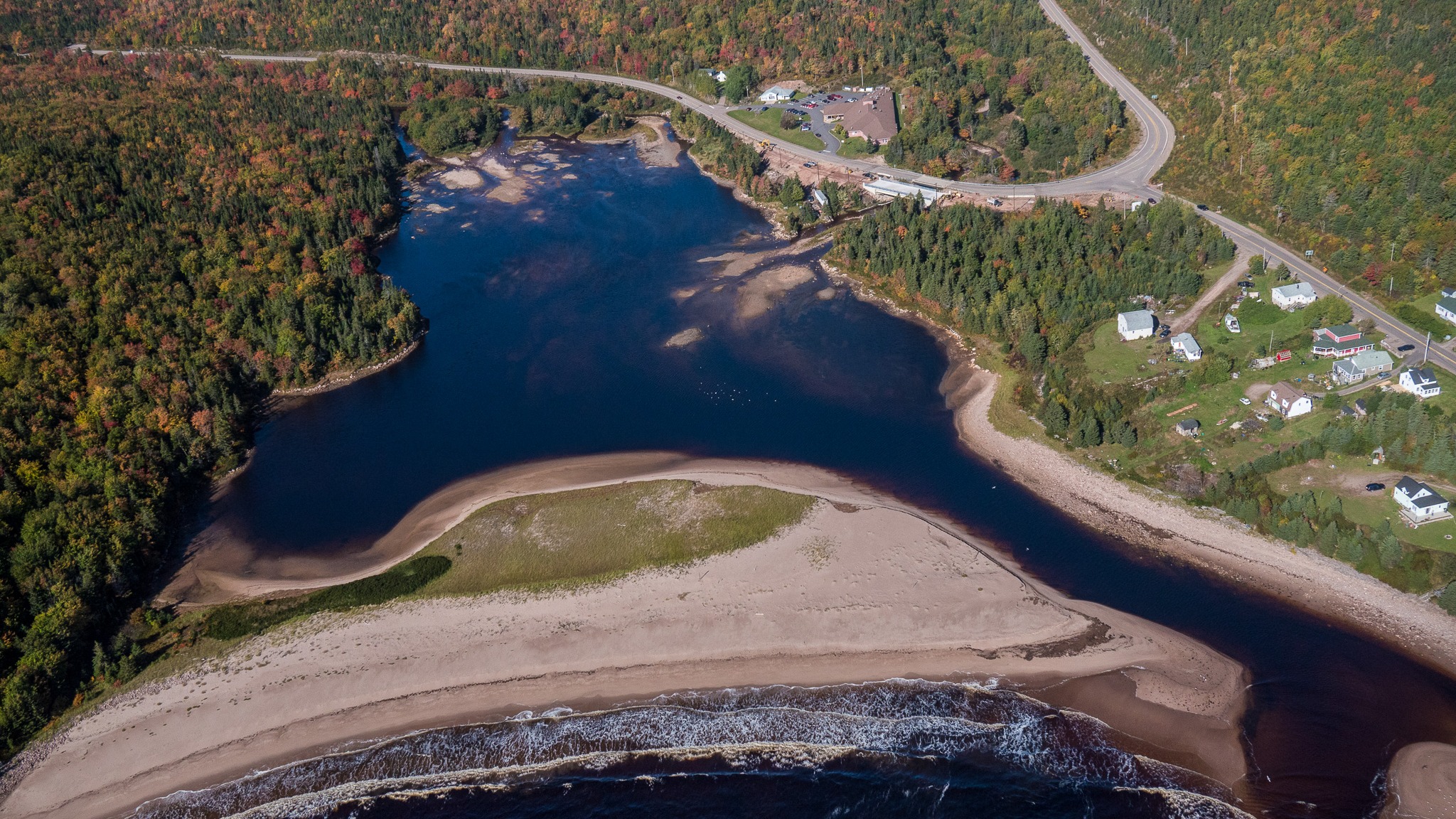
Take a peaceful walk through soft boreal forest to the hidden-gem of Neils Brook Beach.
This trail winds to the lesser-explored end of Neil’s Harbour Beach and opens onto an estuary alive with nature and the dramatic meeting of forest and Atlantic coast. This stroll offers the comfort of sheltering woods and the reward of ocean breeze, making it ideal for families, casual walkers, or anyone seeking a tranquil nature escape
Length: 2.5 km (1.5 mi) return
Rating: Easy – Family-friendly and suitable for all visitors
Elevation: 0 – 45 m (0 – 150 ft)
Time: 45 – 50 minutes
Trailhead Coordinates: 46.807398, -60.344756
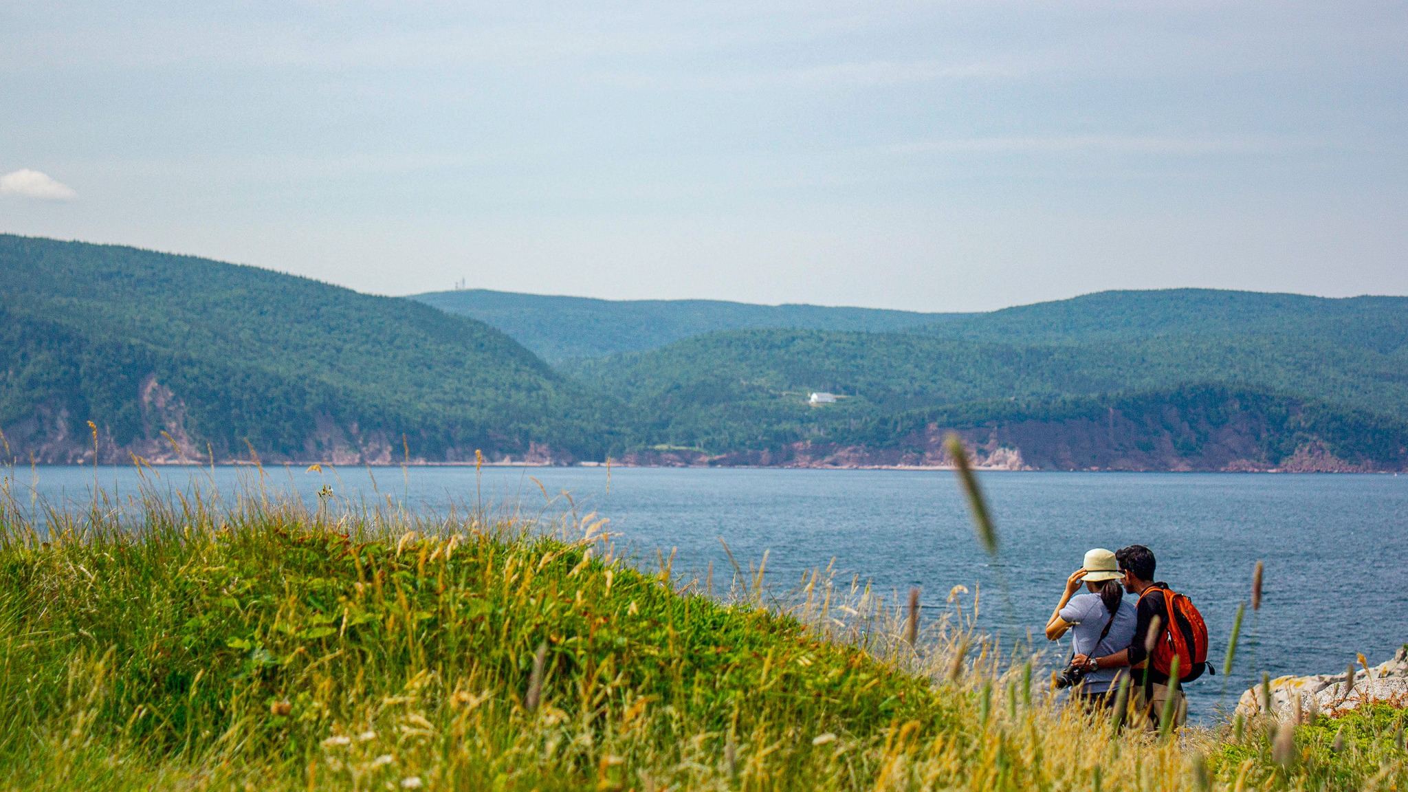
Have you ever dreamed of hiking a trail that feels like it stretches right into the sea? Middle Head in Cape Breton Highlands National Park does exactly that!
This 5.3 km (return) trail follows a long, narrow peninsula separating two sparkling ocean bays and ends on dramatic cliffs with sweeping views of the Atlantic, Cape Smokey, and Ingonish Island.
Along the way, watch for seabirds, seals, whales, eagles, and even fishing boats heading out to sea in early summer.
Discover brand-new interpretive panels that share Mi’kmaq stories and connections to this land and sea, along with insights into the trail’s rich natural and cultural heritage.
Trailhead: Behind Keltic Lodge, Ingonish
(civic address: 383 Keltic In Road, Ingonish)
Lat: 46.655391 Long: -60.372142
Distance: 5.3 km (return)
Elevation: 10 – 55 m (32 – 180 ft)
Time: 1.5–2 hours
Rating: Easy
Park is open year-round but full visitor services are only available from mid-May until mid-October. A park pass is required for hiking or use of other services in the park; park entry fee applies. Check in at the Parks Canada visitor centres in Chéticamp (16 Visitor Centre Rd., situated on the west side of the park) or in Ingonish (37637 Cabot Trail, on the east side of the park) to obtain passes, information on visitor safety and any other information you may need, including a trail location map.
For your comfort and safety:
- Do not approach, disturb or feed wild animals.
- Take along appropriate clothing – rapid weather changes often occur on the plateau or along the coast.
- Carry water with you, especially for longer trails, climbs or open barrens.
- Bring insect repellent as black flies and mosquitoes are common all summer.
- Mountain bikes are permitted only where indicated, for public safety and protection of the environment.
- Stay on designated trails and boardwalks to protect fragile vegetation.
- Do not throw food or scraps along the trails or roads.
- Read "Keep it Wild, Keep it Safe" brochure, available at park visitor centres and on the Parks Canada website.
- Recreational drone use is prohibited within the national park for the safety of wildlife and other visitors.
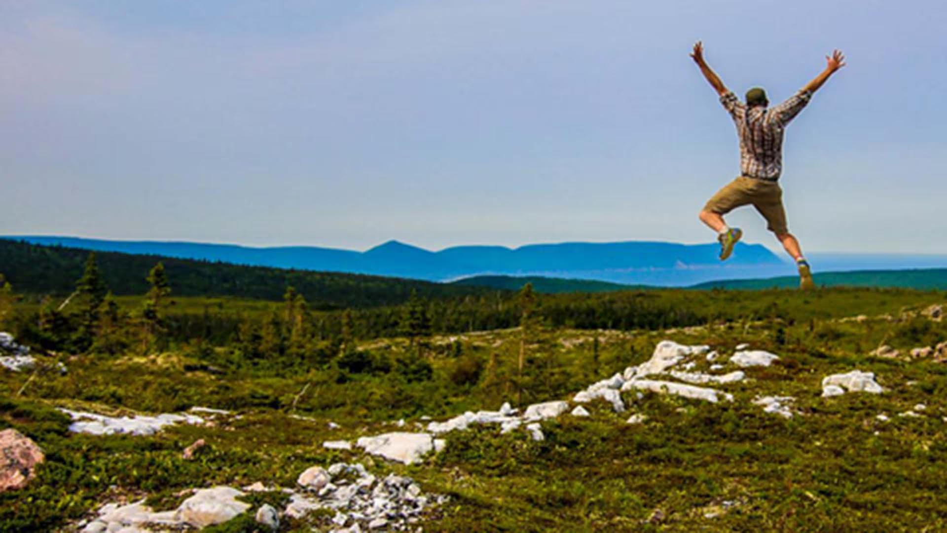
This breathtaking trail winds through Acadian mixed forest and stunted taiga as it climbs to the windswept plateau. It offers 360° views spanning the barrens, the dramatic Aspy fault, coastal villages far below and mountains reaching the most northern tip of Cape Breton. Continue along a narrower footpath to Mica Hill’s remarkable displays of mica glittering amongst the quartz boulders. Explore a small side loop past Paquette Lake on your return.
Trailhead: Take the Paquette Lake road and park at the lake
Significant Feature: Highlands taiga, mica-quartz pegmatite
Length: 7.9 km (4.9 mi) return; 8.4 km (5.2 mi) with loop
Hiking Time: 3–4 hours
Elevation: 260–400 m (850–1345 ft.) Gradual climb.
Trail Rating: Moderate
GPS Co-ordinates for Trailhead (in decimal degrees): Lat: 46.834629 Long: -60.434124
Open from mid-May to mid-October. A park pass is required for hiking or use of other services in the park; park entry fee applies. Check in at the Parks Canada visitor centres in Chéticamp (16 Visitor Centre Rd., situated on the west side of the park) or in Ingonish (37637 Cabot Trail, on the east side of the park) to obtain passes, information on visitor safety and any other information you may need, including a trail location map.
For your comfort and safety:
- Do not approach, disturb or feed wild animals.
- Take along appropriate clothing – rapid weather changes often occur on the plateau or along the coast.
- Carry water with you, especially for longer trails, climbs or open barrens.
- Bring insect repellent as black flies and mosquitoes are common all summer.
- Mountain bikes are permitted only where indicated, for public safety and protection of the environment.
- Stay on designated trails and boardwalks to protect fragile vegetation.
- Do not throw food or scraps along the trails or roads.
- Read "Keep it Wild, Keep it Safe" brochure, available at park visitor centres and on the Parks Canada website.
- Recreational drone use is prohibited within the national park for the safety of wildlife and other visitors.
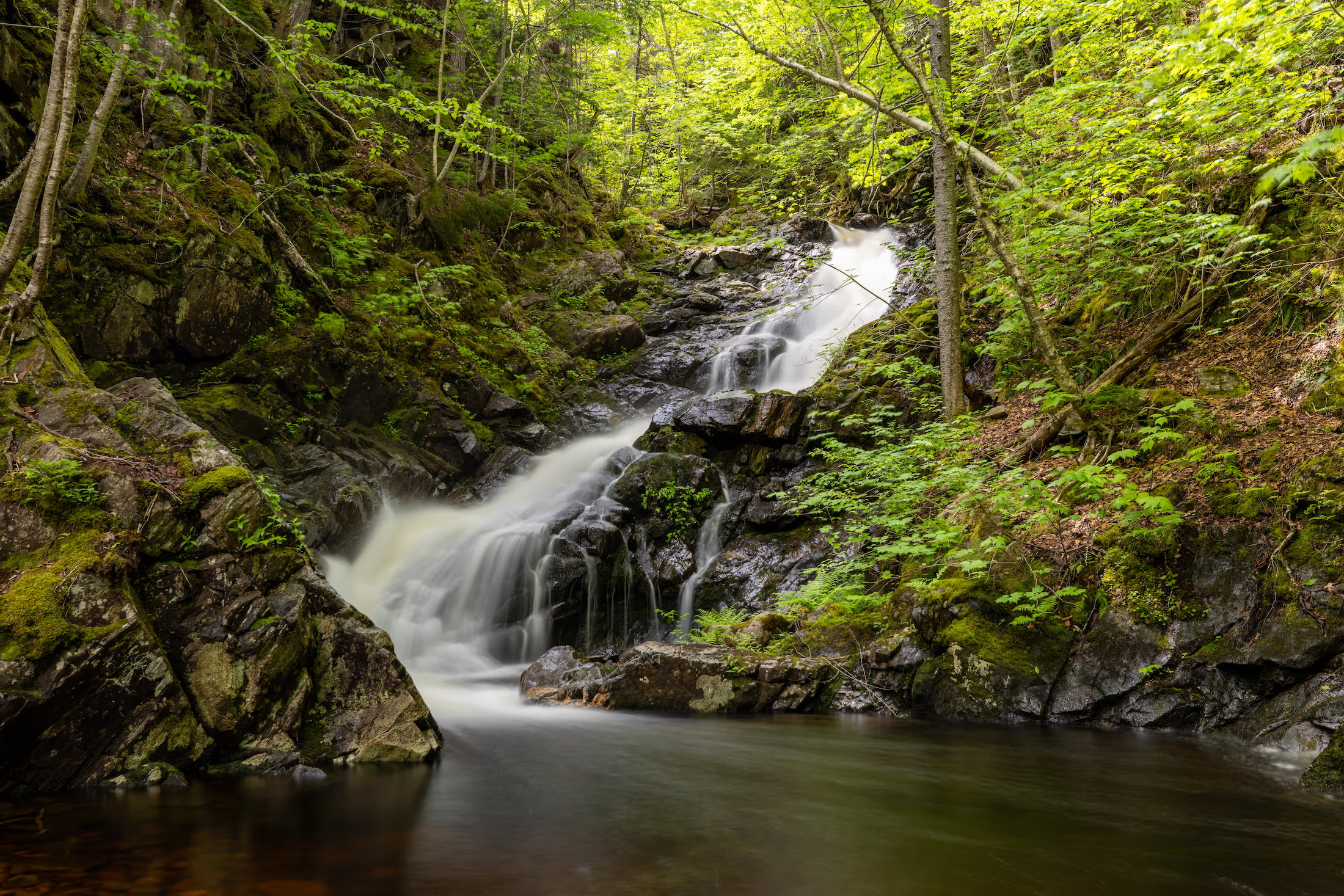
Enjoy a family-friendly, fairly level stroll along a babbling brook and through a mature hardwood forest with a picturesque waterfall at the end. Be serenaded by the songs of forest birds along this relaxing trail. You can even charge your vehicle at the EV charging stations near the trailhead while you hike.
Trailhead: MacIntosh Brook Campground and day use area
Significant Feature: Old growth Acadian forest, waterfall
Length: 1.7 km (1.1 mi) return
Hiking Time: 30–45 min
Elevation: 30–65 m (100–215 ft.)Suitable for most skill levels. Uneven trail surface (exposed roots) in some places.
Trail Rating: Easy
Trailhead: 46°48’43.4"N 60°46’04.3"W
Waterfall: 46°48’29.8"N 60°45’43.8"W
Open from mid-May to mid-October. A park pass is required for hiking or use of other services in the park; park entry fee applies. Check in at the Parks Canada visitor centres in Chéticamp (16 Visitor Centre Rd., situated on the west side of the park) or in Ingonish (37637 Cabot Trail, on the east side of the park) to obtain passes, information on visitor safety and any other information you may need, including a trail location map.
For your comfort and safety:
- Do not approach, disturb or feed wild animals.
- Take along appropriate clothing – rapid weather changes often occur on the plateau or along the coast.
- Carry water with you, especially for longer trails, climbs or open barrens.
- Bring insect repellent as black flies and mosquitoes are common all summer.
- Mountain bikes are permitted only where indicated, for public safety and protection of the environment.
- Stay on designated trails and boardwalks to protect fragile vegetation.
- Do not throw food or scraps along the trails or roads.
- Read "Keep it Wild, Keep it Safe" brochure, available at park visitor centres and on the Parks Canada website.
- Recreational drone use is prohibited within the national park for the safety of wildlife and other visitors.
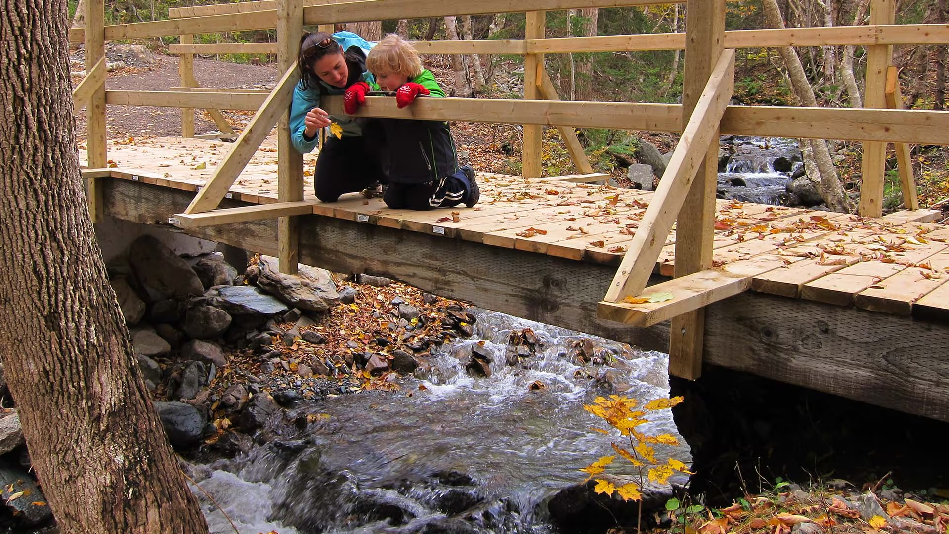
Follow the route of the old Cabot Trail from Trout Brook as it gently climbs to a ridge midway up Jerome Mountain, offering views of the Atlantic along the entire length of this trail. Traces of Acadian history abound, with foundations of an old school and of former residents’ houses along the trail. The old wharf at La Bloc is also visible at various points on the journey. Your efforts will be rewarded at the final look-off featuring spectacular views of Presqu’île and the Gulf of St. Lawrence. An exhibit at the look-off provides further information on the families who used to live here.
Trailhead: On the Cabot Trail across from Trout Brook
Significant Features: Acadian history, ocean view
Length: 8.8 km (5.5 mi) return
Time: 2–3 hours
Elevation: 40–110 m (130–360 ft)
Long, gentle climb. Suitable for most skill levels.
Trail Rating: Easy
GPS Co-ordinates for Trailhead (in decimal degrees): Lat: 46.714762 Long: -60.933245
Park is open year-round but full visitor services are only available from mid-May until mid-October. A park pass is required for hiking or use of other services in the park; park entry fee applies. Check in at the Parks Canada visitor centres in Chéticamp (16 Visitor Centre Rd., situated on the west side of the park) or in Ingonish (37637 Cabot Trail, on the east side of the park) to obtain passes, information on visitor safety and any other information you may need, including a trail location map.
For your comfort and safety:
– Do not approach, disturb or feed wild animals.
– Take along appropriate clothing – rapid weather changes often occur on the plateau or along the coast.
– Carry water with you, especially for longer trails, climbs or open barrens.
– Bring insect repellent as black flies and mosquitoes are common all summer.
– Mountain bikes are permitted only where indicated, for public safety and protection of the environment.
– Stay on designated trails and boardwalks to protect fragile vegetation.
– Do not throw food or scraps along the trails or roads.
– Read "Keep it Wild, Keep it Safe" brochure, available at park visitor centres and on the Parks Canada website.- Recreational drone use is prohibited within the national park for the safety of wildlife and other visitors.
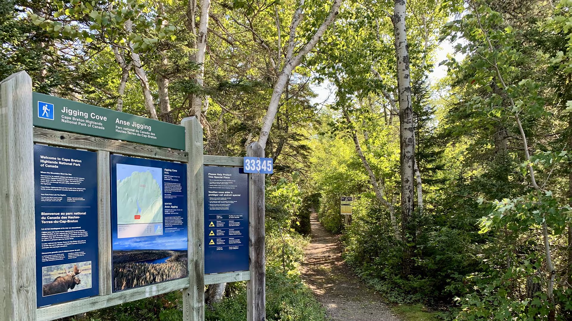
Birders and other nature lovers will enjoy the varied wildlife on this short relaxing trail, following the shoreline of a small man-made lake. The trail name comes from a nearby cove, where fishermen used to jig for cod.
Trailhead: Parking lot on the Cabot Trail
Significant Feature: Acadian forest, lake
Length: 2.15 km (1.6 mi) loop
Hiking Time: 2–3 hours
Elevation: 0–65 m (0–215 ft.)
Trail Rating: Easy – Level trail. Narrow with wet sections.
GPS Co-ordinates for Trailhead (in decimal degrees): Lat: 46.787754 Long: -60.346626
Park is open year-round but full visitor services are only available from mid-May until mid-October. A park pass is required all year for hiking or use of other services in the park; park entry fee applies. Check in at the Parks Canada visitor centres in Chéticamp (16 Visitor Centre Rd., situated on the west side of the park) or in Ingonish (37637 Cabot Trail, on the east side of the park) to obtain passes, information on visitor safety and any other information you may need, including a trail location map.
For your comfort and safety:
- Do not approach, disturb or feed wild animals.
- Take along appropriate clothing – rapid weather changes often occur on the plateau or along the coast.
- Carry water with you, especially for longer trails, climbs or open barrens.
- Bring insect repellent as black flies and mosquitoes are common all summer.
- Mountain bikes are permitted only where indicated, for public safety and protection of the environment.
- Stay on designated trails and boardwalks to protect fragile vegetation.
- Do not throw food or scraps along the trails or roads.
- Read "Keep it Wild, Keep it Safe" brochure, available at park visitor centres and on the Parks Canada website.- Recreational drone use is prohibited within the national park for the safety of wildlife and other visitors.
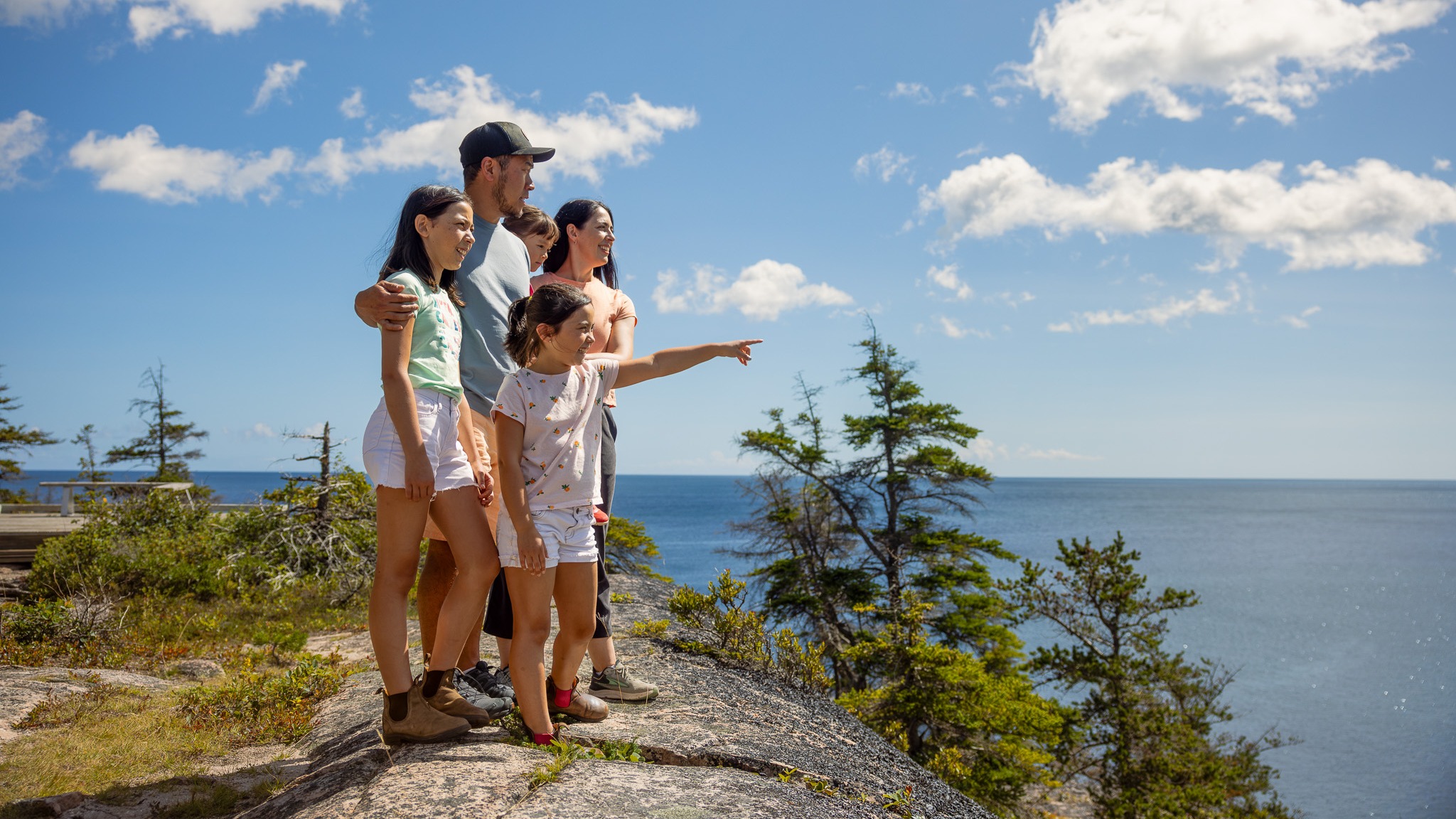
Discover the serene beauty of the Jack Pine Trail in Cape Breton Highlands National Park. This short loop trail winds through a unique stand of jack pine with sweeping views of the Atlantic coastline.
This trail can be easily accessed from the Cabot Trail at Black Brook day-use area, this hike delivers both drama and calm in one short outing.
Whether you’re hiking solo, with friends, or with someone special, it’s the perfect way to connect with nature and let the sea-air refresh your spirit.
Trailhead: Turn off the Cabot Trail at the Black Brook day use area and turn left to the upper parking lot.
Significant Feature: Atlantic coastline
Length: 2.3 km (1.4 mi) loop
Hiking Time: 1 hour
Elevation: 10–55 m (35–180 ft.)Interpretive loop. Short climbs. Some rocky, rugged sections.
Trail Rating: Easy – Family-friendly trail suitable for all visitors
GPS Co-ordinates for Trailhead (in decimal degrees):
Lat: 46.778569 Long: -60.332248
Park is open year-round but full visitor services are only available from mid-May until mid-October. A park pass is required all year for hiking or use of other services in the park; park entry fee applies. Check in at the Parks Canada visitor centres in Chéticamp (16 Visitor Centre Rd., situated on the west side of the park) or in Ingonish (37637 Cabot Trail, on the east side of the park) to obtain passes, information on visitor safety and any other information you may need, including a trail location map.
For your comfort and safety:
- Do not approach, disturb or feed wild animals.
- Take along appropriate clothing – rapid weather changes often occur on the plateau or along the coast.
- Carry water with you, especially for longer trails, climbs or open barrens.
- Bring insect repellent as black flies and mosquitoes are common all summer.
- Mountain bikes are permitted only where indicated, for public safety and protection of the environment.
- Stay on designated trails and boardwalks to protect fragile vegetation.
- Do not throw food or scraps along the trails or roads.
- Read "Keep it Wild, Keep it Safe" brochure, available at park visitor centres and on the Parks Canada website.- Recreational drone use is prohibited within the national park for the safety of wildlife and other visitors.
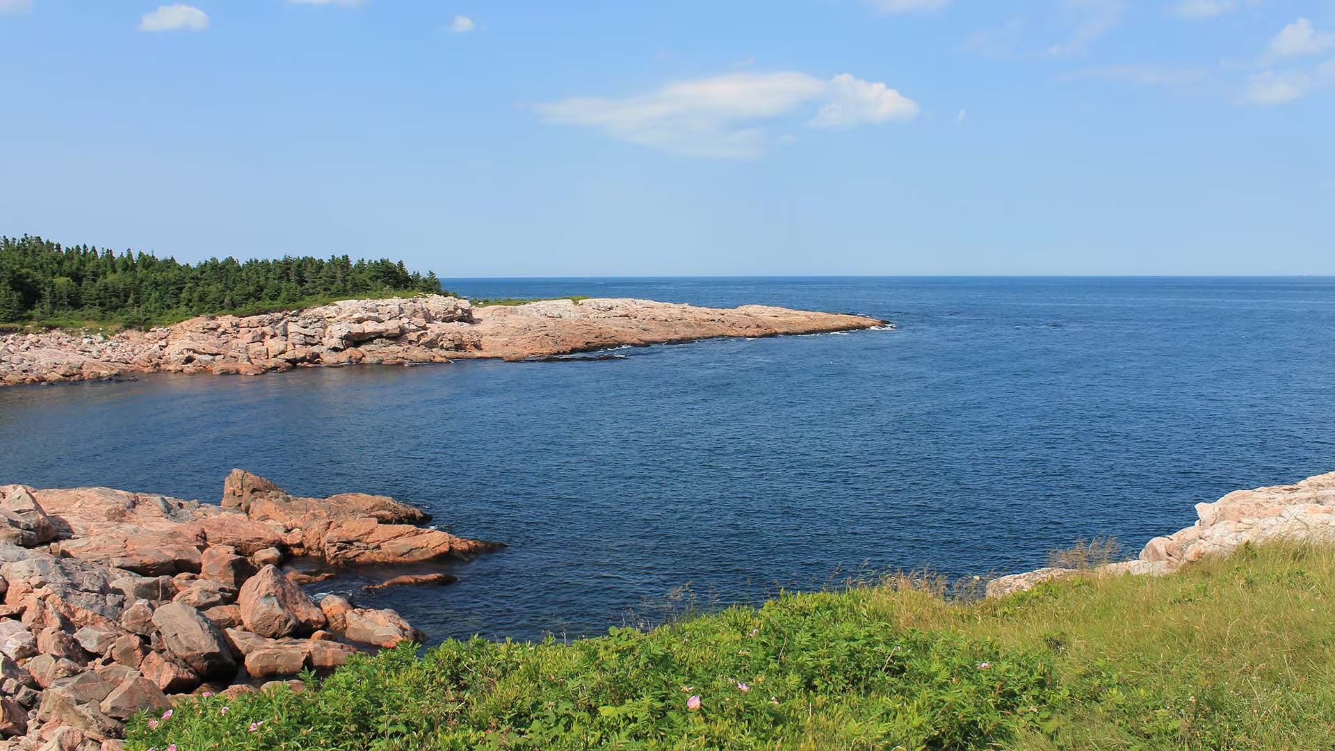
Although this trail is very short, a mere “leg stretcher”, it is quite fascinating. From this rocky granite headland jutting out into the sea, you can watch the ocean crash against the rocks or catch a glimpse of whales offshore as fishermen tend to their lobster traps, daring to come so close to the rocks. Notice the twisted stunted trees – known as “krummholz” – and the leathery leaves of the bayberry. Plants here have adapted to this windy, salt-sprayed coastal environment.
Caution: Keep away from rock edges during high wind and waves and always use caution around dark rocks.
Trailhead: Parking lot on the Cabot Trail
Significant Feature: Atlantic coastline, geology
Length: 0.2-km (0.1-mi) loop
Hiking Time: 10 minutes
Elevation: 10 m (35 ft.)
Trail Rating: Easy
GPS Co-ordinates for Trailhead (in decimal degrees):
Lat: 46.750779 Long: -60.324785
Park is open year-round but full visitor services are only available from mid-May until mid-October. A park pass is required all year for hiking or use of other services in the park. Check in at the Parks Canada Visitor Centres in Chéticamp (16 Visitor Centre Road, just off the Cabot Trail on the west side of the park) or in Ingonish (37637 Cabot Trail, on the east side of the park) to obtain passes, information on visitor safety and any other information you may need, including a trail location map.
For your comfort and safety:
- Do not approach, disturb or feed wild animals.
- Take along appropriate clothing – rapid weather changes often occur on the plateau or along the coast.
- Carry water with you, especially for longer trails, climbs or open barrens.
- Bring insect repellent as black flies and mosquitoes are common all summer.
- Mountain bikes are permitted only where indicated, for public safety and protection of the environment.
- Stay on designated trails and boardwalks to protect fragile vegetation.
- Do not throw food or scraps along the trails or roads.
- Read "Keep it Wild, Keep it Safe" brochure, available at park visitor centres and on the Parks Canada website.- Recreational drone use is prohibited within the national park for the safety of wildlife and other visitors