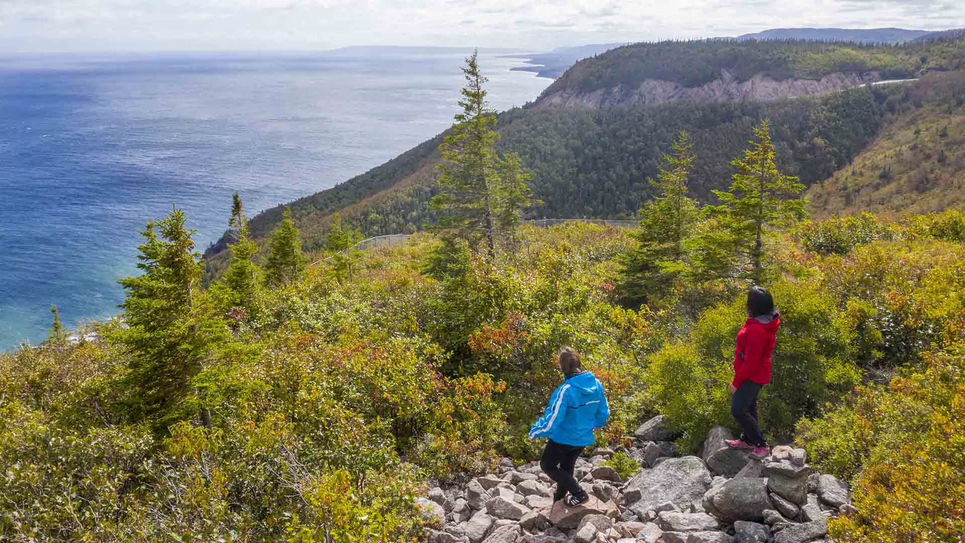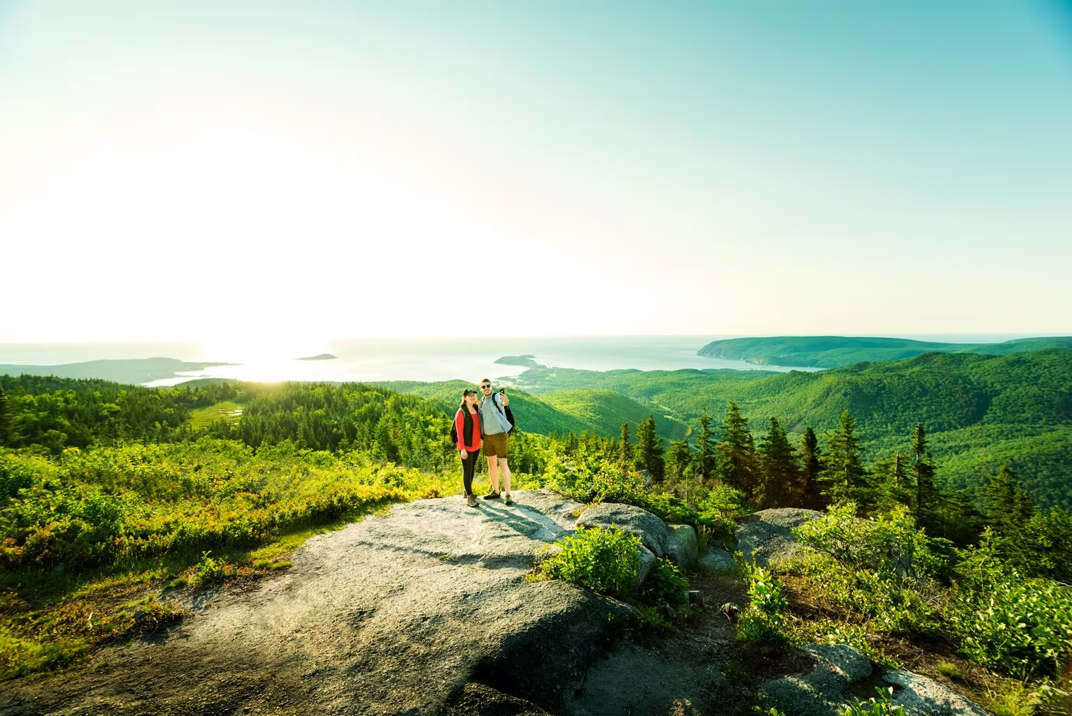
Climb through a lush forest to one of the park’s most breathtaking summits. At the top, expansive 360° views reveal the Clyburn Brook canyon, the Atlantic coastline from Cape Smokey to Ingonish, and the dramatic rocky face of Franey Mountain. Moose are often spotted along the way, adding to the wilderness experience.
The trail has been recently realigned to offer two scenic loops, both leading to unforgettable vistas. Access the trailhead at the end of Franey Road.
Length:
4.5 km / 2.7 mi (lower loop)
13 km / 8 mi (full loop)
Rating: Difficult — Longer trails with steep sections suitable for prepared visitors with trail experience.
Elevation:
17 – 170 m (55 – 557 ft) (lower loop)
17 – 423 m (55 – 1,387 ft) (full loop)
Time:
1.5 – 2 hours (lower loop)
5 – 6 hours (full loop)
GPS Co-ordinates for Trailhead (in decimal degrees): Lat: 46.660766, Long: -60.422683
Open from mid-May to mid-October. A park pass is required for hiking or use of other services in the park; park entry fee applies. Check in at the Parks Canada visitor centres in Chéticamp (16 Visitor Centre Rd., situated on the west side of the park) or in Ingonish (37637 Cabot Trail, on the east side of the park) to obtain passes, information on visitor safety and any other information you may need, including a trail location map.
For your comfort and safety:
- Do not approach, disturb or feed wild animals.
- Take along appropriate clothing – rapid weather changes often occur on the plateau or along the coast.
- Carry water with you, especially for longer trails, climbs or open barrens.
- Bring insect repellent as black flies and mosquitoes are common all summer.
- Mountain bikes are permitted only where indicated, for public safety and protection of the environment.
- Stay on designated trails and boardwalks to protect fragile vegetation.
- Do not throw food or scraps along the trails or roads.
- Read "Keep it Wild, Keep it Safe" brochure, available at park visitor centres and on the Parks Canada website.
- Recreational drone use is prohibited within the national park for the safety of wildlife and other visitors.
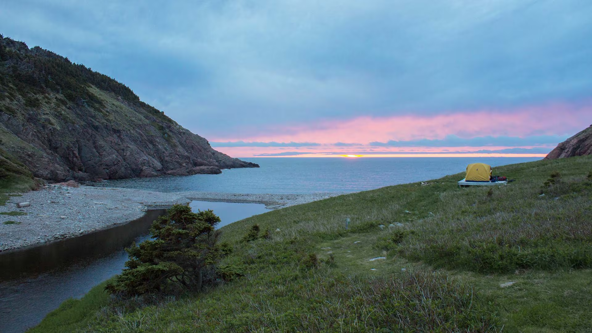
You are 355 metres (1165 feet) above sea level!
Hike from the top of the mountain about 6 kilometres down to a small ocean cove and grassy clearing – the only designated wilderness camp site in the park. This was once the site of a Scottish fishing community and these settlers traded with the French for supplies. Explore the beach, roam the hills or swim in fresh or salt water. You must register at a Parks Canada visitor centre prior to camping.
Trailhead: On the Cabot Trail at the top of MacKenzie Mountain.
Significant Feature: Acadian forest, ocean cove and headlands
Length: 12 km (7.5 mi) return
Hiking Time: 5–6 hours
Elevation: 0–355 m (0–1165 ft.) Steep descent. Some muddy sections. No potable water on site. If camping, bring your own toilet paper.
Trail Rating: Difficult
GPS Co-ordinates for Trailhead (in decimal degrees): Lat: 46.761030 Long: -60.834544
Park is open year-round but full visitor services are only available from mid-May until mid-October.
A park pass is required all year for hiking or use of other services in the park; park entry fee applies. Check in at the Parks Canada visitor centres in Chéticamp (16 Visitor Centre Rd., situated on the west side of the park) or in Ingonish (37637 Cabot Trail, on the east side of the park) to obtain passes, information on visitor safety and any other information you may need, including a trail location map.
For your comfort and safety:
- Do not approach, disturb or feed wild animals.
- Take along appropriate clothing – rapid weather changes often occur on the plateau or along the coast.
- Carry water with you, especially for longer trails, climbs or open barrens.
- Bring insect repellent as black flies and mosquitoes are common all summer.
- Mountain bikes are permitted only where indicated, for public safety and protection of the environment.
- Stay on designated trails and boardwalks to protect fragile vegetation.
- Do not throw food or scraps along the trails or roads.
- Read "Keep it Wild, Keep it Safe" brochure, available at park visitor centres and on the Parks Canada website.- Recreational drone use is prohibited within the national park for the safety of wildlife and other visitors.
Cape Smokey Provincial Park is on top of Smokey Mountain along the Cabot Trail on Cape Breton Island.
With picnic tables and incredible look-off views, Cape Smokey is a popular rest stop for visitors to the Cabot Trail and the Cape Breton Highlands National Park area. The park has great bird watching and photography opportunities.
A trail, 5 km (3.1 mi) each way, offers even more spectacular views. Rest stops are provided along the way. Allow 4 hours for this hiking trail.
Note: Infrastructure improvements in the park may cause delays or reduce services while we complete this important work. We appreciate your understanding at this time.
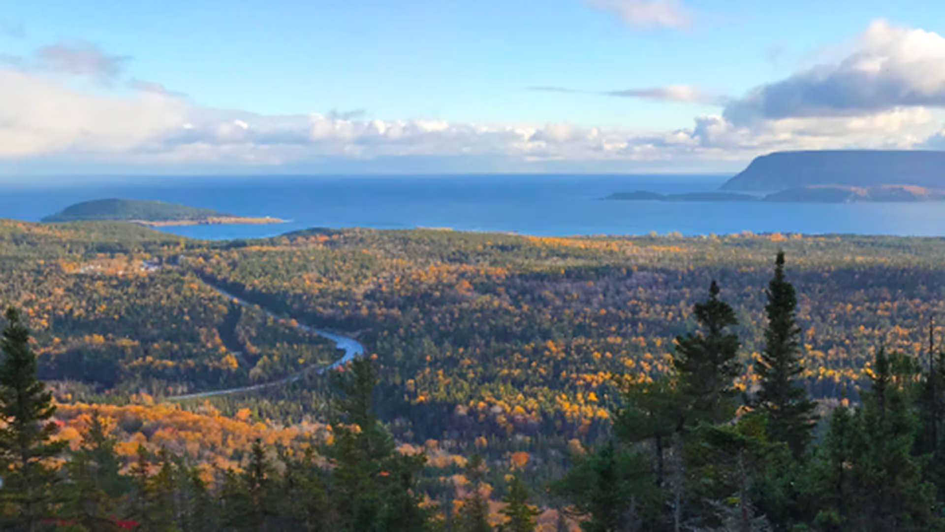
This switchback trail leads through a dense forest of softwood to the top of Broad Cove Mountain for exceptional views of the rocky Atlantic coast, with Middle Head and Cape Smokey in the distance. You climb 168 m over a distance of 1.6 km. Watch for moose along the way and eagles as they soar overhead. Relax at the top and enjoy the vistas below.
Trailhead: A small parking lot about 1/3 of the way in on Warren Lake Road
Significant Feature: Ocean, mountain scenery, fall colours
Length: 2.3 km (1.4 mi) return
Hiking Time: 1 hour
Elevation: 35–180 m (115–590 ft.)Short, steep climb. Rugged sections.
Trail Rating: Moderate
GPS Co-ordinates for Trailhead (in decimal degrees): Lat: 46.7155114 Long: -60.370568
Park is open year-round but full visitor services are only available from mid-May until mid-October. A park pass is required for hiking or use of other services in the park; park entry fee applies. Check in at the Parks Canada visitor centres in Chéticamp (16 Visitor Centre Rd., situated on the west side of the park) or in Ingonish (37637 Cabot Trail, on the east side of the park) to obtain passes, information on visitor safety and any other information you may need, including a trail location map.
For your comfort and safety:
- Do not approach, disturb or feed wild animals.
- Take along appropriate clothing – rapid weather changes often occur on the plateau or along the coast.
- Carry water with you, especially for longer trails, climbs or open barrens.
- Bring insect repellent as black flies and mosquitoes are common all summer.
- Mountain bikes are permitted only where indicated, for public safety and protection of the environment.
- Stay on designated trails and boardwalks to protect fragile vegetation.
- Do not throw food or scraps along the trails or roads.
- Read "Keep it Wild, Keep it Safe" brochure, available at park visitor centres and on the Parks Canada website.- Recreational drone use is prohibited within the national park for the safety of wildlife and other visitors.