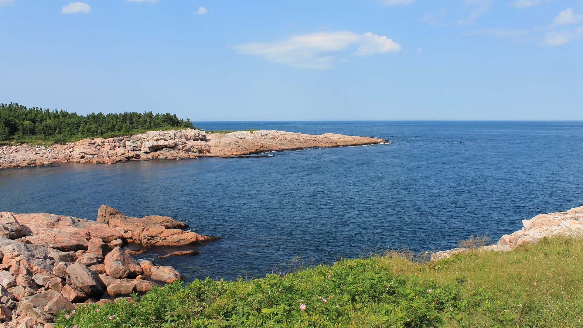
Although this trail is very short, a mere “leg stretcher”, it is quite fascinating. From this rocky granite headland jutting out into the sea, you can watch the ocean crash against the rocks or catch a glimpse of whales offshore as fishermen tend to their lobster traps, daring to come so close to the rocks. Notice the twisted stunted trees – known as “krummholz” – and the leathery leaves of the bayberry. Plants here have adapted to this windy, salt-sprayed coastal environment.
Caution: Keep away from rock edges during high wind and waves and always use caution around dark rocks.
Trailhead: Parking lot on the Cabot Trail
Significant Feature: Atlantic coastline, geology
Length: 0.2-km (0.1-mi) loop
Hiking Time: 10 minutes
Elevation: 10 m (35 ft.)
Trail Rating: Easy
GPS Co-ordinates for Trailhead (in decimal degrees):
Lat: 46.750779 Long: -60.324785
Park is open year-round but full visitor services are only available from mid-May until mid-October. A park pass is required all year for hiking or use of other services in the park. Check in at the Parks Canada Visitor Centres in Chéticamp (16 Visitor Centre Road, just off the Cabot Trail on the west side of the park) or in Ingonish (37637 Cabot Trail, on the east side of the park) to obtain passes, information on visitor safety and any other information you may need, including a trail location map.
For your comfort and safety:
- Do not approach, disturb or feed wild animals.
- Take along appropriate clothing – rapid weather changes often occur on the plateau or along the coast.
- Carry water with you, especially for longer trails, climbs or open barrens.
- Bring insect repellent as black flies and mosquitoes are common all summer.
- Mountain bikes are permitted only where indicated, for public safety and protection of the environment.
- Stay on designated trails and boardwalks to protect fragile vegetation.
- Do not throw food or scraps along the trails or roads.
- Read "Keep it Wild, Keep it Safe" brochure, available at park visitor centres and on the Parks Canada website.- Recreational drone use is prohibited within the national park for the safety of wildlife and other visitors
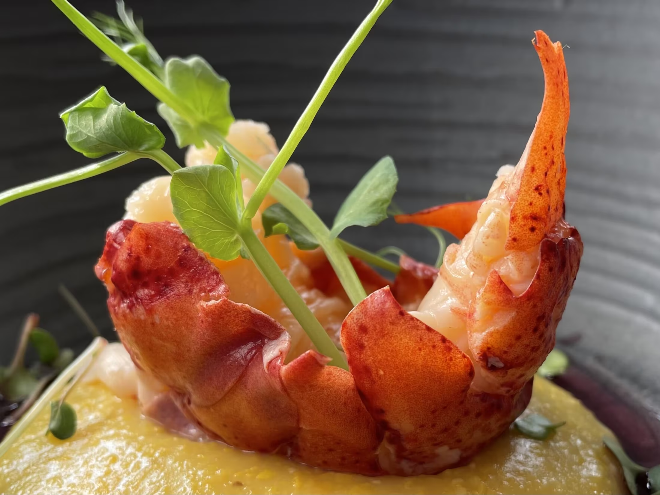
GRÁ is situated on a 150 acre sustainable farm located on the Bras d’Or Lake on Cape Breton Island. We produce various types of produce, herbs, flowers, and animals using farming techniques that protect the environment and foster the development of healthy living. GRÁ translated from Gaelic means love. GRÁ allows its guests to dine on food grown just a few feet away using traditional cooking techniques with an emphasis on seasonality, freshness and a menu that accommodates what is harvested from the garden and surrounding area on a daily basis. Our goal is to grow 70% of the produce the restaurant uses – and the other 30% is locally sourced. Great care is taken supporting local farms and businesses found on the island. It is our way of strengthening the community. Cape Breton Island’s motto “Your Heart Will Never Leave” and Cherie’s Earth-to-Table cuisine is the perfect storm providing her customers a culinary experience not available anywhere else on Cape Breton Island.
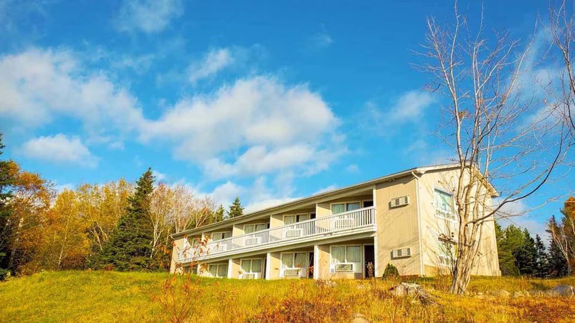
Glenghorm Resort is situated on 20 acres in Ingonish on the world-famous Cabot Trail, Cape Breton Island. Enjoy the many activities we have to offer, or relax on our expansive private beach. Nearby activities include outdoor adventure tours (such as whale watching) and a fresh water lake with a lifeguard on duty in July and August. While staying with us explore Ingonish, hike one of the many trails in Cape Breton Highlands National Park or play a round of golf at Highlands Links which is just five kilometres away.
Our accommodations include 40 guest units (Double bed, Queen-sized bed, King-sized bed; 22 motor inn; 10 cottages; 8 deluxe suites with fireplaces), with a 3-piece (shower) or 4-piece bath. Cots are available. Guest features include a games room, children’s play area, and ocean swimming. Restaurant and pub in main building.
We are a non-smoking property. Small pets are permitted, with restrictions. We are a proud member of the Tourism Industry Association of Nova Scotia. Visa and Mastercard are accepted.
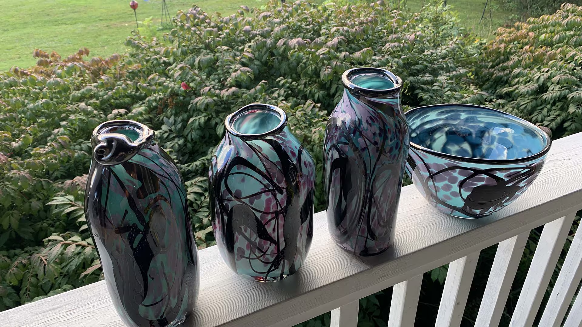
A glass gallery featuring over 40 glass artisans. Visit our glass-blowing studio and watch how it’s made. We also offer a class for you to try.
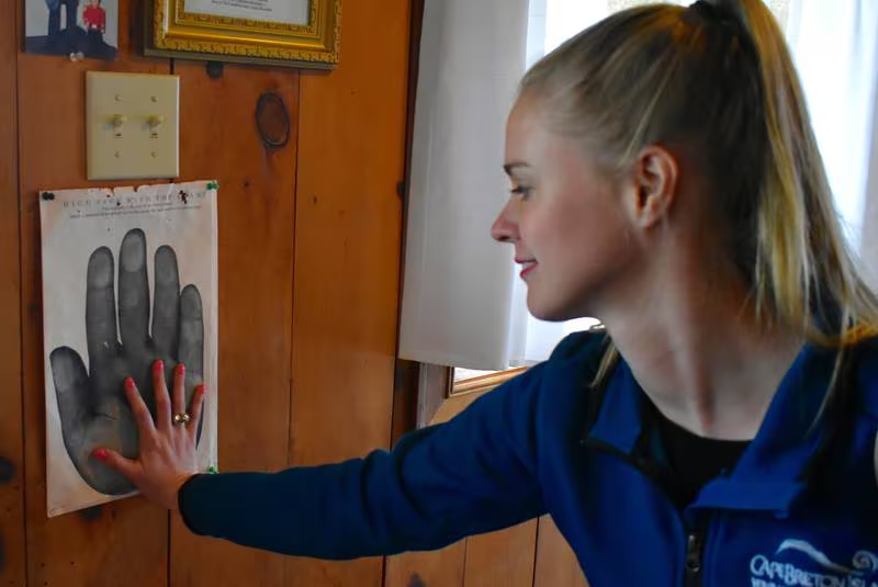
The mission of the museum is to preserve the legacy of Giant Angus MacAskill through education and numerous displays.
Angus MacAskill was billed by the Guinness Book of World Records as the Tallest and Strongest Man (non-pathological) in the 1981 edition. He is recorded as standing seven feet nine inches tall and weighing 425 pounds. His tales are legendary; stories show him to be a gentleman and a role model.
The museum is located 2.5 km off Hwy 105, Exit 12 on Route 312.
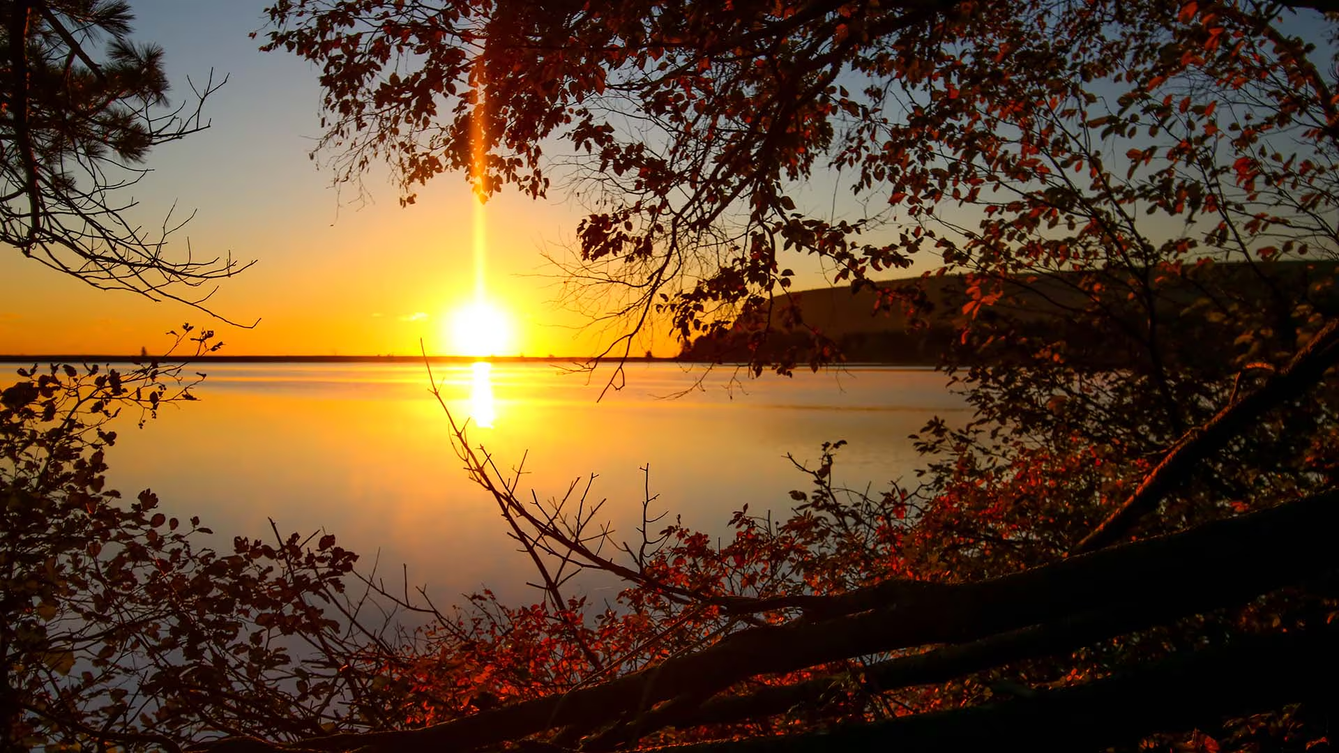
Starting next to the ocean, this short, level trail follows the shoreline of a small lake that was once an ocean bay. A side trail (1.6 km return) follows the cobble barrier beach which separates the lake from the Atlantic Ocean. Hear the unique song of the loon, or catch a glimpse of one from the viewing deck. Complete your stroll with a dip in the ocean or in Freshwater Lake itself. Bicycles are permitted on this trail but pedestrians have the right of way.
Trailhead: The Ingonish Beach Day Use Area parking lot Significant Feature: Atlantic coastline, lake, beaver pondLength: 1.7 km (1.1 mi)Hiking Time: 30–40 minutesElevation: 0–15 m (0–50 ft) Level, wheelchair-accessible trail. Suitable for families with young children.
Trail Rating: Easy
GPS Co-ordinates for Trailhead (in decimal degrees):
Lat: 46.650291 Long: -60.390789
Park is open year-round but full visitor services are only
available from mid-May until mid-October. A park pass is required all year for hiking or use of other services in the park; park entry fee applies. Check in at the Parks Canada visitor centres in Chéticamp (16 Visitor Centre Rd., situated on the west side of the park) or in Ingonish (37637 Cabot Trail, on the east side of the park) to obtain passes, information on visitor safety and any other information you may need, including a trail location map.
For your comfort and safety:
– Do not approach, disturb or feed wild animals.
– Take along appropriate clothing – rapid weather changes often occur on the plateau or along the coast.
– Carry water with you, especially for longer trails, climbs or open barrens.
– Bring insect repellent as black flies and mosquitoes are common all summer.
– Mountain bikes are permitted only where indicated, for public safety and protection of the environment.
– Stay on designated trails and boardwalks to protect fragile vegetation.
– Do not throw food or scraps along the trails or roads.
– Read “Keep it Wild, Keep it Safe” brochure, available at park visitor centres and on the Parks Canada website.- Recreational drone use is prohibited within the national park for the safety of wildlife and other visitors
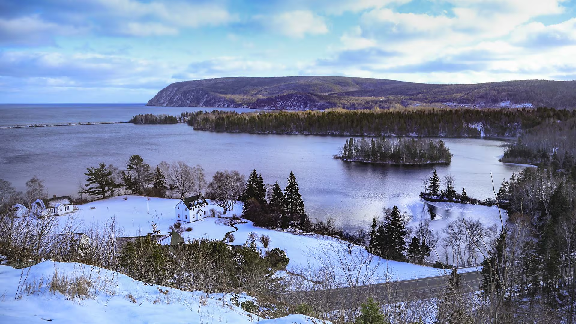
Short but steep, or, steep but short! Wooden stairs lead to a picturesque vista unfolds before you: Ingonish Beach, Freshwater Lake, Middle Head and Cape Smokey. If you don’t have time for a longer hike to get a view, then this trail is for you. Children enjoy it also but be careful at the top.
Trailhead: On the Cabot Trail, across from the Park’s Administration Building in Ingonish
Significant Feature: Atlantic coastline
Length: 0.3 km (0.2 mi) return
Hiking Time: 10 minutes
Elevation: 10 – 45 m (35 – 150 ft.)
Trail Rating: Moderate
GPS Co-ordinates for Trailhead (in decimal degrees):
Lat: 46.646010 Long: -60.402759
Park is open year-round but full visitor services are only available from mid-May until mid-October. A park pass is required all year for hiking or use of other services in the park. Check in at the Parks Canada Visitor Centres in Chéticamp (16 Visitor Centre Road, just off the Cabot Trail on the west side of the park) or in Ingonish (37637 Cabot Trail, on the east side of the park) to obtain passes, information on visitor safety and any other information you may need, including a trail location map.
For your comfort and safety:
- Do not approach, disturb or feed wild animals.
- Take along appropriate clothing – rapid weather changes often occur on the plateau or along the coast.
- Carry water with you, especially for longer trails, climbs or open barrens.
- Bring insect repellent as black flies and mosquitoes are common all summer.
- Mountain bikes are permitted only where indicated, for public safety and protection of the environment.
- Stay on designated trails and boardwalks to protect fragile vegetation.
- Do not throw food or scraps along the trails or roads.
- Read "Keep it Wild, Keep it Safe" brochure, available at park visitor centres and on the Parks Canada website.- Recreational drone use is prohibited within the national park for the safety of wildlife and other visitors
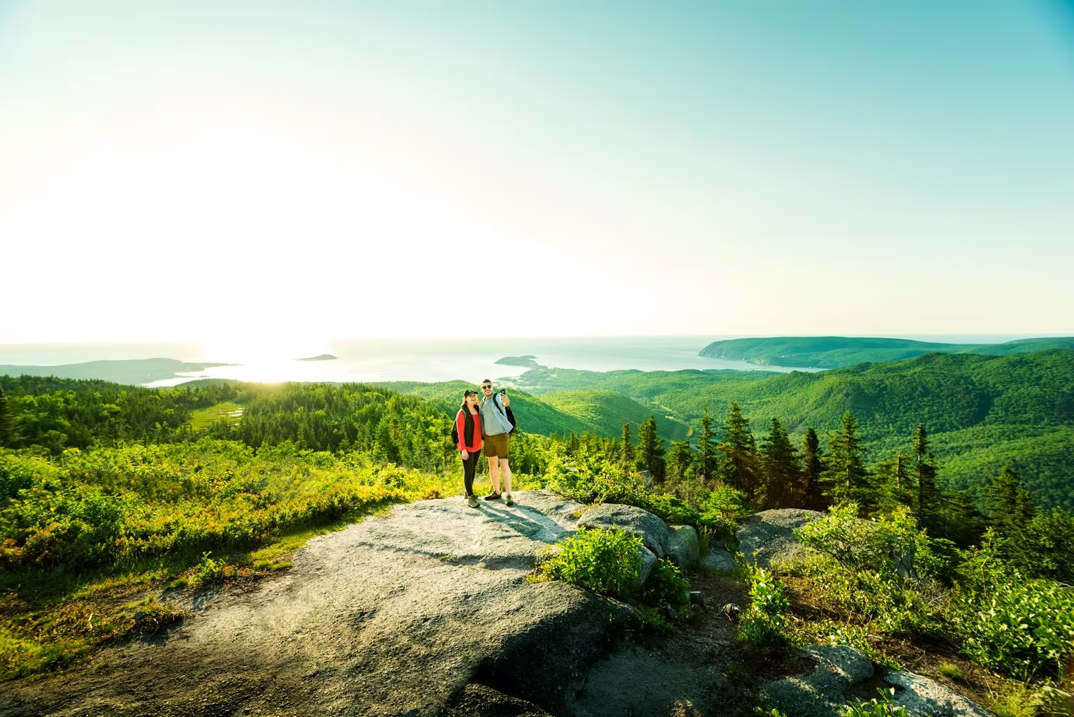
Climb through a lush forest to one of the park’s most breathtaking summits. At the top, expansive 360° views reveal the Clyburn Brook canyon, the Atlantic coastline from Cape Smokey to Ingonish, and the dramatic rocky face of Franey Mountain. Moose are often spotted along the way, adding to the wilderness experience.
The trail has been recently realigned to offer two scenic loops, both leading to unforgettable vistas. Access the trailhead at the end of Franey Road.
Length:
4.5 km / 2.7 mi (lower loop)
13 km / 8 mi (full loop)
Rating: Difficult — Longer trails with steep sections suitable for prepared visitors with trail experience.
Elevation:
17 – 170 m (55 – 557 ft) (lower loop)
17 – 423 m (55 – 1,387 ft) (full loop)
Time:
1.5 – 2 hours (lower loop)
5 – 6 hours (full loop)
GPS Co-ordinates for Trailhead (in decimal degrees): Lat: 46.660766, Long: -60.422683
Open from mid-May to mid-October. A park pass is required for hiking or use of other services in the park; park entry fee applies. Check in at the Parks Canada visitor centres in Chéticamp (16 Visitor Centre Rd., situated on the west side of the park) or in Ingonish (37637 Cabot Trail, on the east side of the park) to obtain passes, information on visitor safety and any other information you may need, including a trail location map.
For your comfort and safety:
- Do not approach, disturb or feed wild animals.
- Take along appropriate clothing – rapid weather changes often occur on the plateau or along the coast.
- Carry water with you, especially for longer trails, climbs or open barrens.
- Bring insect repellent as black flies and mosquitoes are common all summer.
- Mountain bikes are permitted only where indicated, for public safety and protection of the environment.
- Stay on designated trails and boardwalks to protect fragile vegetation.
- Do not throw food or scraps along the trails or roads.
- Read "Keep it Wild, Keep it Safe" brochure, available at park visitor centres and on the Parks Canada website.
- Recreational drone use is prohibited within the national park for the safety of wildlife and other visitors.